


Konigsberg (now the city of Kaliningrad) was founded as a castle and was a fortress city throughout almost the entire history of the existence of Konigsberg.
How it all started - the construction of fortifications (a brief history)
Since the foundation of the castle by the Teutonic Order (Koenigsberg Castle) in the 13th century (1255 - the beginning of construction), a settlement began to develop on the high bank of the river, which later grew into a city. In memory of the Czech king, who led the campaign of the volunteer knights of the Teutonic Order to the new lands, the newly erected castle was named "Konigsberg" ("Royal Mountain"), which, in turn, later gave the name to the whole city.
To protect the castle and the nearby settlement from the enemy, a medieval ring of defensive walls began to be erected in 1355.
In the first half of the 1600s, the construction of the First val defensive perimeter began, which surrounded the entire Konigsberg with nearby communities, fortifications along a circular perimeter.
In 1843, the construction of the Second val fortification (defensive belt) began, during which the modernization of existing ones and the construction of additional city fortifications took place. The second fortification consisted of: ramparts (earthen embankment), ditches, defensive barracks and walls, bastions, Fort Friedrichsburg, defensive towers of the Don and Wrangel, and entrance gates to the city.
The rapid development of military affairs in the 19th century led to the fact that by the end of the century the Second fortification could not protect the city from enemies. In 1910, all the fortifications were sold by the War Ministry to the city administration. At about the same time, in order to ensure the development of the sprawling city, part of the bypass structures (roller fortifications) were demolished, some of the buildings were destroyed and demolished.
In addition to the ring fortification of the city, located directly around the settlement (the Second fortification), there was another protection belt - the outer one, located more remotely from the city and included a ring of forts erected in the 19th century, which were used until the end of World War II.
In total, 15 forts were erected around the city: 12 main ones and three to strengthen the defense (intermediate small fortifications - 1a, 2a and 5a). The forts surrounded Konigsberg along a circular perimeter and were the first defensive ring defense when the enemy attacked (outside of the city). The forts were located at such a distance from each other that when the enemy invaded, crossfire could be carried out from the forts, preventing the enemy from breaking deeper - to the city.
Fortifications of Konigsberg at the present time
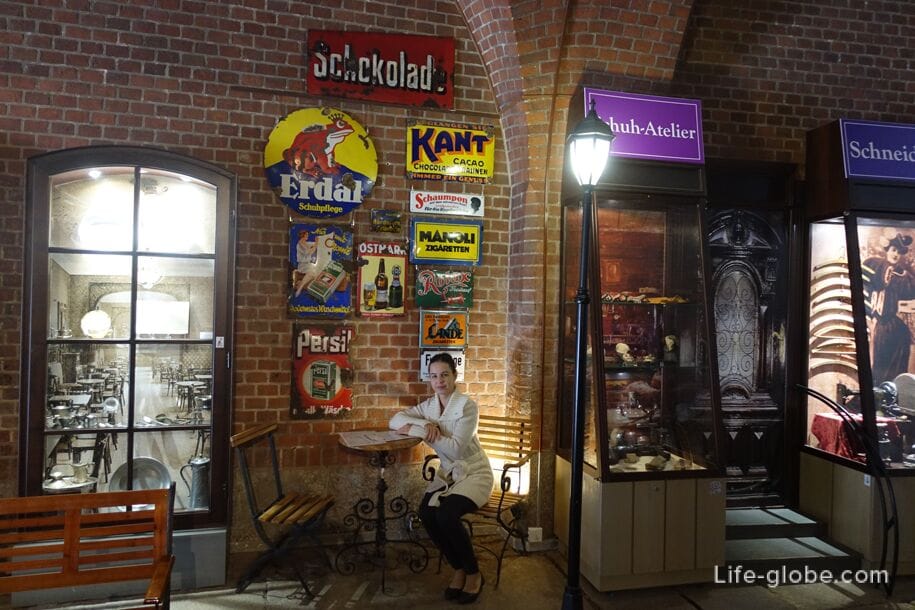
At present, only a small part of the objects that are now architectural monuments, mainly of the Neo-Gothic period, remains of the former defensive structures surrounding Konigsberg: 7 city gates, redoubts of bastions, gates of the fortress-fort Friedrichsburg, towers, part of the wall, ravelins, defensive barracks and the remains of forts.
Many of the remains of fortifications have been restored and museums, art spaces, restaurants or shops are located in them today. While others are still in a dilapidated state.
Kaliningrad Fortification Route
At present, the recommended route "Kaliningrad fortification" has been laid out in Kaliningrad, taking a walk along which you can see all the preserved, now reconstructed, remains of former fortifications: gates, towers, part of the wall, reduits of bastions, Lithuanian rampart, ravelins and barracks.
The route also includes forts. However, if you can visit the fortifications around the city even on foot, then you will have to go to the forts by public transport or taxi.
If desired, you can choose only a few objects that interest you and visit them separately. The route can start from any object and end, respectively, also at any object.
Objects of Kaliningrad fortification
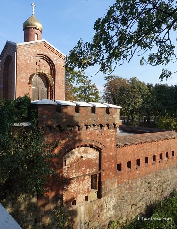
Wrangel Tower
The Wrangel Tower, also known as the Wrangel Tower, was erected in 1853-1856. It is named after Field Marshal Friedrich Heinrich Ernst von Wrangel.
This tower, together with the Don Tower, were designed to cover The Upper Lake, as the weakest point in the defense of the city.
Currently, the passage to the tower is closed.
The address of the tower "Wrangel": Proletarskaya Street, 2 / Professor Baranov, 2a.
Coordinates of the Wrangel Tower": 54°43'21"N (54.722580), 20°30'50"E (20.514119). Learn more about the Wrangel Tower...
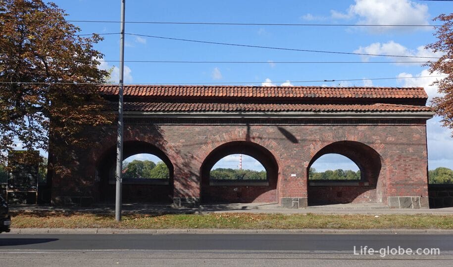
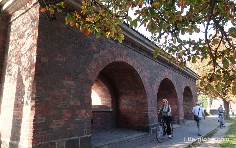
A section of the defensive wall (The combat position of a three-gun battery)
The wall, the remains of which can be seen today (a section of the defensive wall, the part of the defensive wall), was erected in the middle of the 19th century, had defensive significance and was under the cover of cross defensive fire, the implementation of which was possible from the towers "Wrangel" and "Don".
The architectural advantages of the brick wall are emphasized by arches and stylized embrasures with cornices.
It is noteworthy that until 1945, in the embrasures of the wall there were barrels of ancient artillery guns attached by chains to metal hinges. The gun barrels were removed in the post-war years.
The wall is located near the Upper Lake on Chernyakhovsky Street.
Coordinates of the combat position of the three - gun battery: 54°43'17"N (54.721473), 20°31'15"E (20.520947).
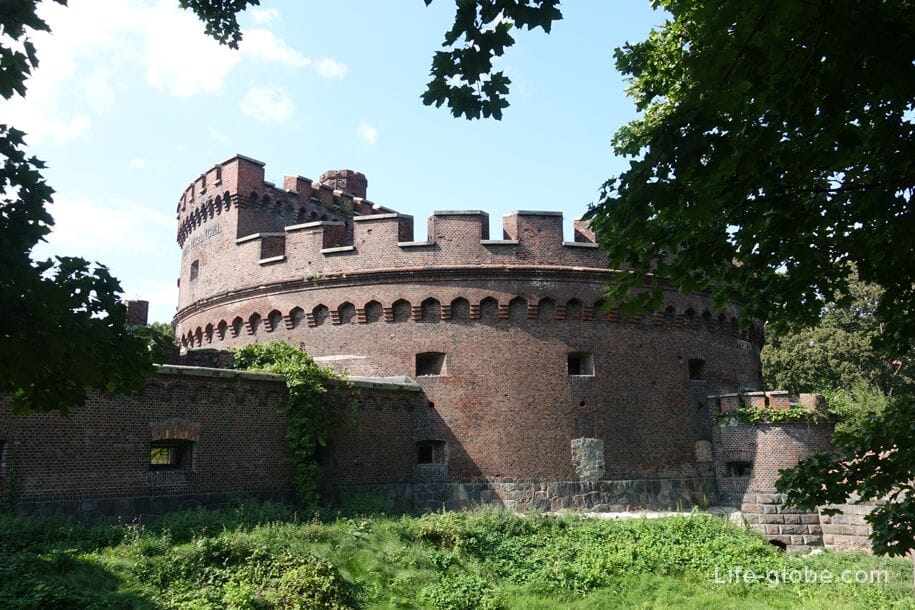
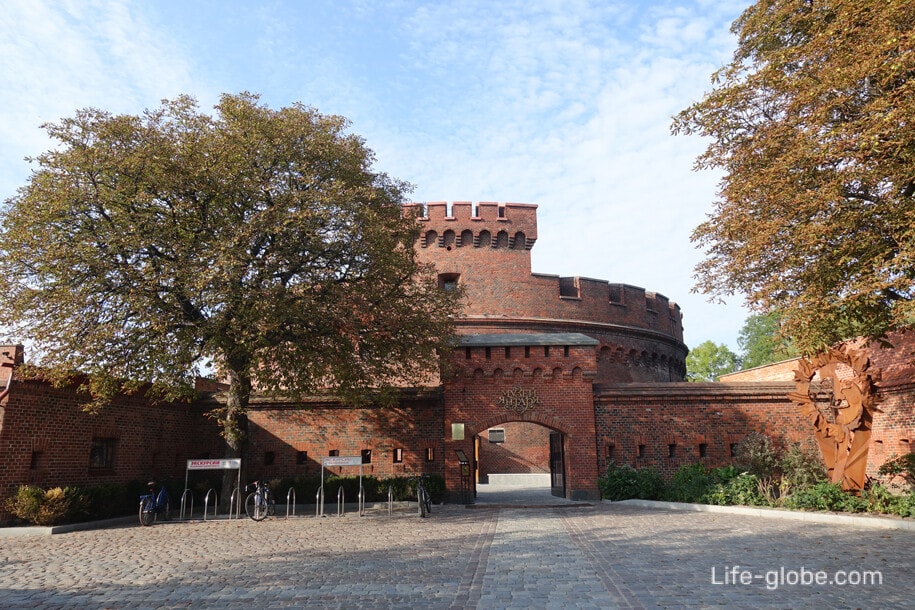
The Dona Tower
The Dona Tower was erected in the Neo-Gothic style in 1853 on the southeastern shore of Lake Superior and named after the Prussian Field Marshal Friedrich Karl Dona, a participant in the liberation war of 1812 against Napoleonic France.
In terms of the tower is a ring with a diameter of 34 meters and a height of 12 meters with a courtyard and three tiers-floors, including underground.
In April 1945, during the assault on Konigsberg, the garrison of the Dona Tower surrendered last, thereby marking the end of the assault on the fortress city. On April 10, the red Victory banner was hoisted on the tower.
Since 1979, the Amber Museum has been located in the walls of the Dona Tower, the collection of collections of which has become famous in many countries of the world.
Address of the Dona Tower and the Amber Museum: Marshal Vasilevsky Square, 1.
Coordinates of the Dona Tower and the Amber Museum: 54°43'20"N (54.722362), 20°31'22"E (20.523055). Learn more about the Dona Tower and the Amber Museum...
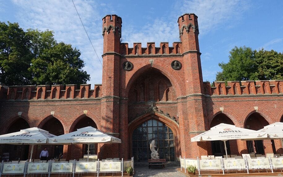
Rosgarten Gate
The current Rosgarten Gate (Roßgärter Tor) replaced the previous version of the gate of the early 17th century and was built between 1852 and 1855 under the direction of Wilhelm Ludwig Sturmer.
During the Second World War, the Rossgarten Gate was damaged, but subsequently restored.
Currently, there is a cafe-restaurant "Sunny Stone" in the gate.
Address of the Rosgarten Gate: the intersection of Chernyakhovsky and Alexander Nevsky streets, near Vasilevsky Square and the Amber Museum.
Coordinates of the Rosgarten Gate: 54°43'19"N (54.722031), 20°31'25"E (20.523782). Learn more about the Rossgarten Gate...
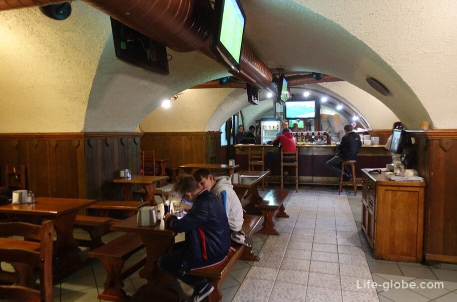
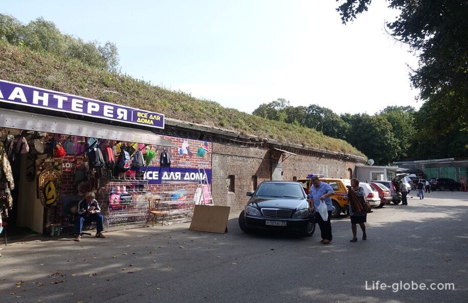
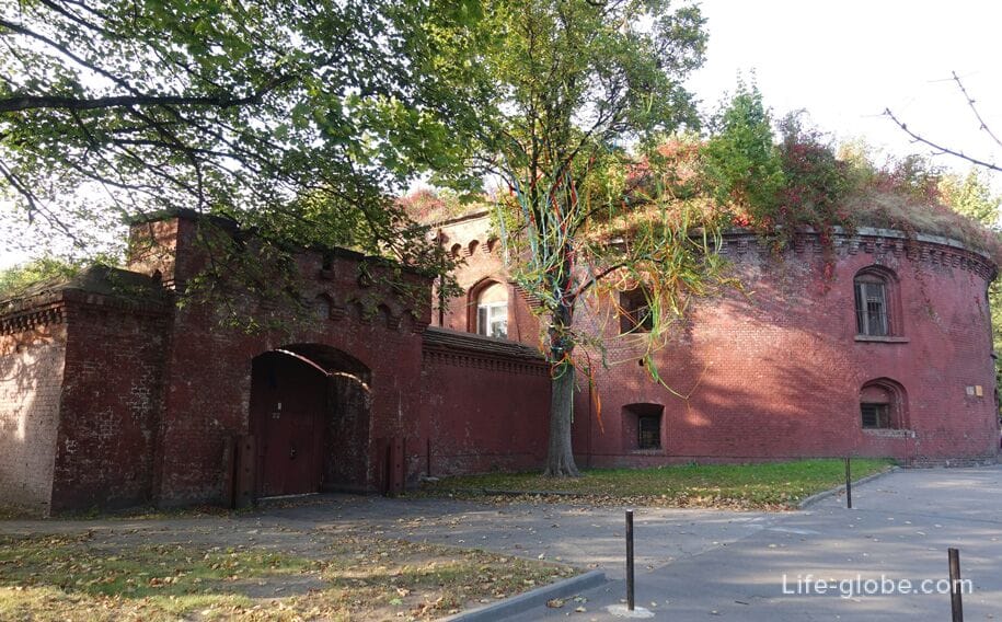
Reduit bastion "Oberteich" (Lithuanian shaft)
The reduit of the Oberteich bastion was built in the middle of the 19th century (1856-1860) according to the project of the chief of the engineering corps, Infantry General Ernst Ludwig von Aster. Subsequently, the reduit was repeatedly upgraded.
At the time of construction, the reduit was part of the bastion of the same name (built in 1850) with an earthen rampart intended to accommodate artillery positions.
In the post-war period, the bastion was partially rebuilt, and the interior was redeveloped. Now private commercial premises are located in the walls of the reduit.
The bastion consists of a reduit, a reduit casemate, a half-caponier, five casemated traverses, a moat and an escarpment.
The address of the Obertaich bastion is 1/3 and 5 Litovsky Val Street.
Coordinates of the "Oberteich" bastion": 54°43'19"N (54.722168), 20°31'35"E (20.526645).
Moat and escarpment of the "Oberteich" bastion. More about the reduit of the Oberteich bastion...
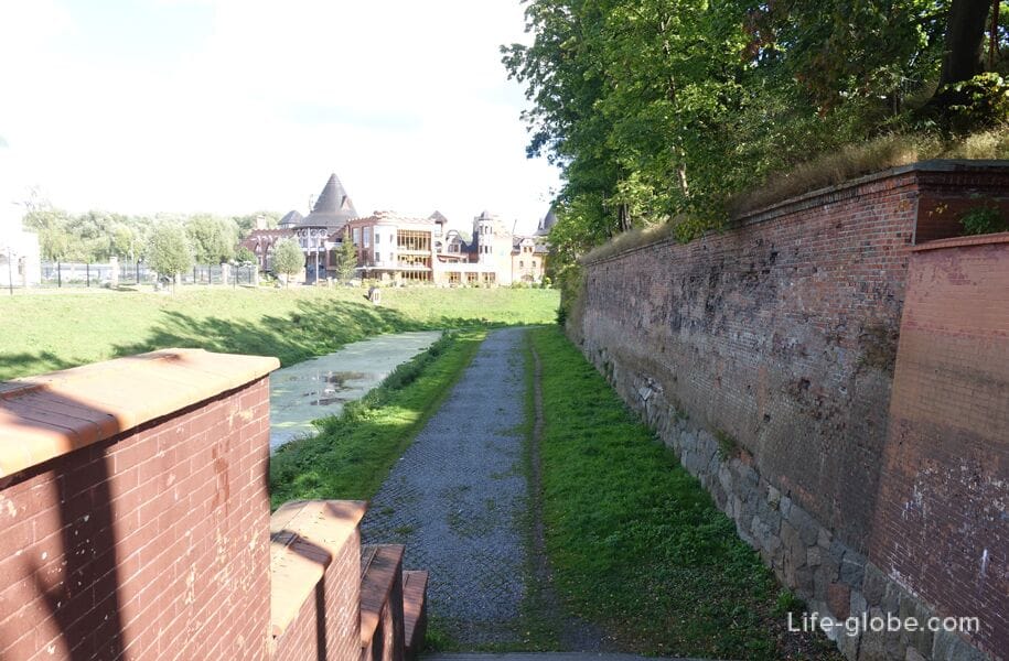
Above the level of the moat of the bastion there is an earthen embankment of the Lithuanian shaft, along which you can walk.

Bastion "Grolman"
The Grolman bastion was built in 1851 by Ernst Ludwig von Aster.
The bastion is named after General Karl Wilhelm von Grolmann.
This bastion is the best preserved fortress structure of Konigsberg with a full set of fortifications inherent in it: a horseshoe-shaped reduit with a courtyard space for sheltering personnel, an earthen rampart, a caponier, two half-caponiers, two casemates of the guard part, entrance gates and a bridgehead fortification.
The Grolman bastion was connected by an underground passage to the neighboring building - the Kronprinz barracks.
The bastion was destroyed and was taken on April 7-8, 1945.
The address of the bastion "Grolman": Litovsky Val street, 21.
Coordinates of the bastion "Grolman": 54°43'3"N (54.717584), 20°31'59"E (20.533267). More about the Grolman bastion...
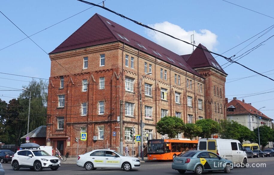
The Crown Prince Barracks
The Kronprinz Defensive Barracks was laid down on October 15, 1843, according to the project of Ernst Ludwig von Aster. Finally built in 1849.
The barracks got its name in honor of the heir to the Prussian throne, William I.
Immediately after the construction, the barracks were occupied by elite units of the Konigsberg garrison.
The Kronprin barracks consists of a main U-shaped building with two side wings. The main building, wings and rear buildings form an inner courtyard. Stylized loopholes are placed in the battlements on the side of the redan tower facing the courtyard.
During the assault on Konigsberg, in April 1945, the barracks received minor damage.
Currently, a branch of the Moscow State University of Technology and Management named after K.G. Razumovsky is located in the walls of the barracks.
Address of the Kronprinz barracks: 38 Litovsky Val Street.
Coordinates of the Crown Prince Barracks: 54°43'0"N (54.716671), 20°31'51"E (20.531036). More about the Crown Prince Barracks...

Lost in the Lithuanian shaft
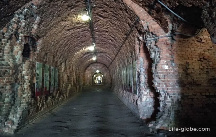
In the Lithuanian shaft there are closed poterns - underground corridors (galleries, passages) intended for communication between fortifications.
The Poterns were often located in a hidden place, which allowed the besieged to come and go unnoticed. In the event of a siege, the defenders could make inconspicuous sorties and attack the besiegers.
Also, the tanks could be used as casemates to accommodate soldiers.
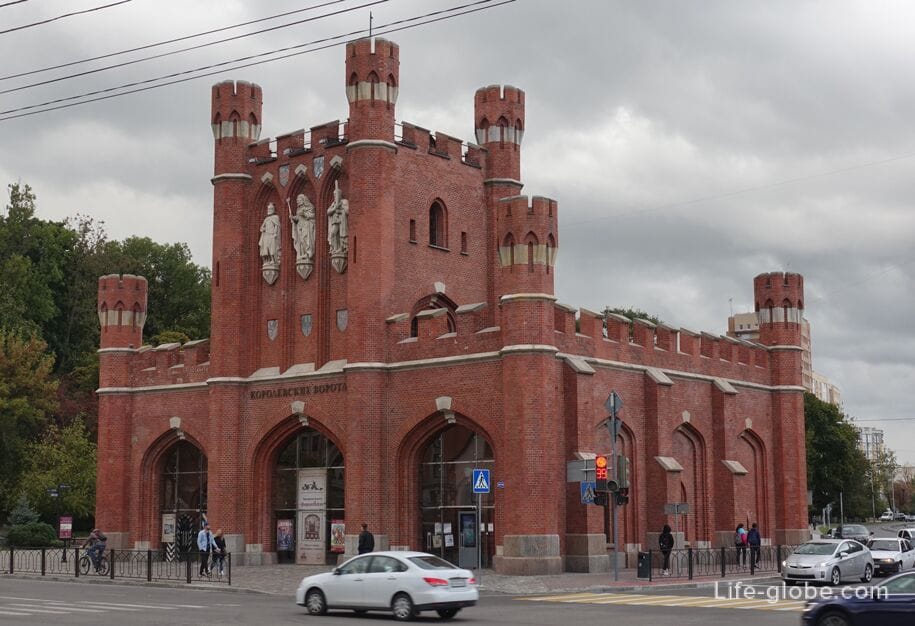
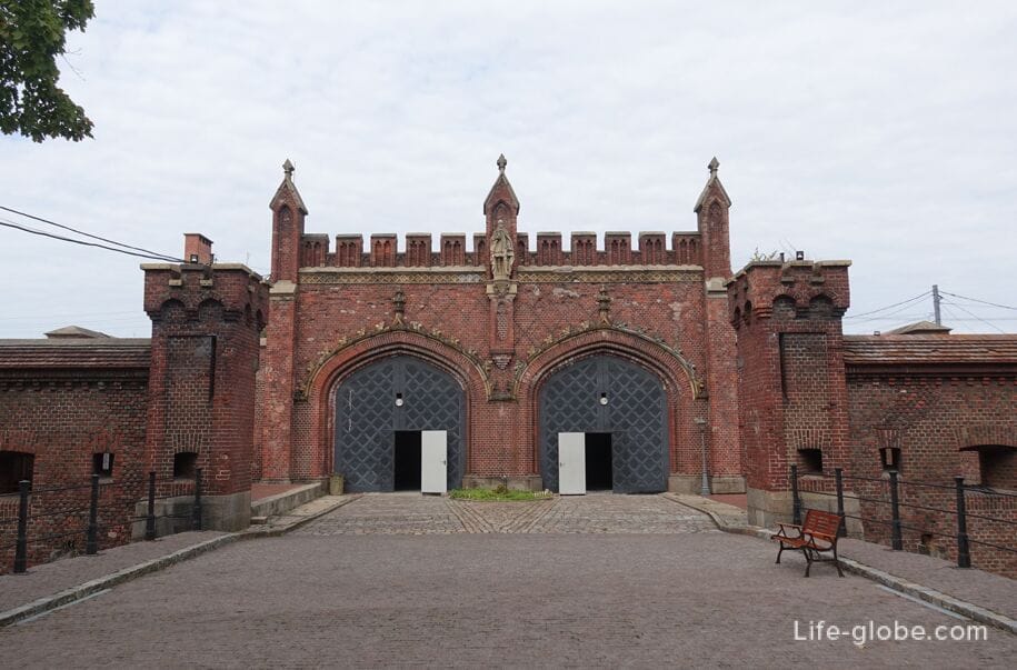
The Royal Gate
The laying of the current Royal Gate (Königstor Tor) took place in August 1843 with the participation of nobles and King Frederick William IV of Prussia. The construction was completed in 1850.
The gate is made of red brick in a pronounced Neo-Gothic style.
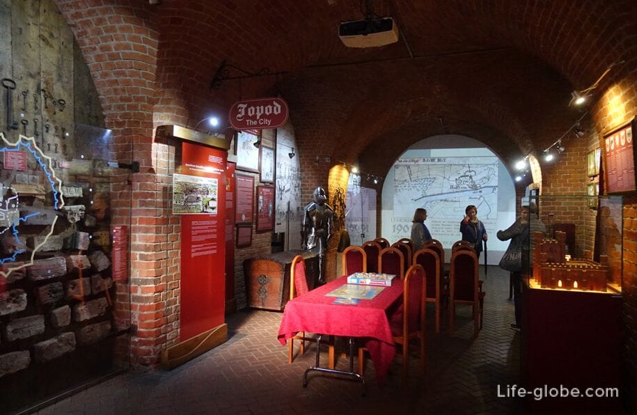
Today, the museum - Historical and Cultural Center "The Great Embassy" is located in the Royal Gate.
Address of the Royal Gate: 112 Frunze Street (intersection of Frunze streets/Yuri Gagarin and the Lithuanian Shaft).
Coordinates of the Royal Gate: 54°42'49"N (54.713716), 20°32'9"E (20.535976).
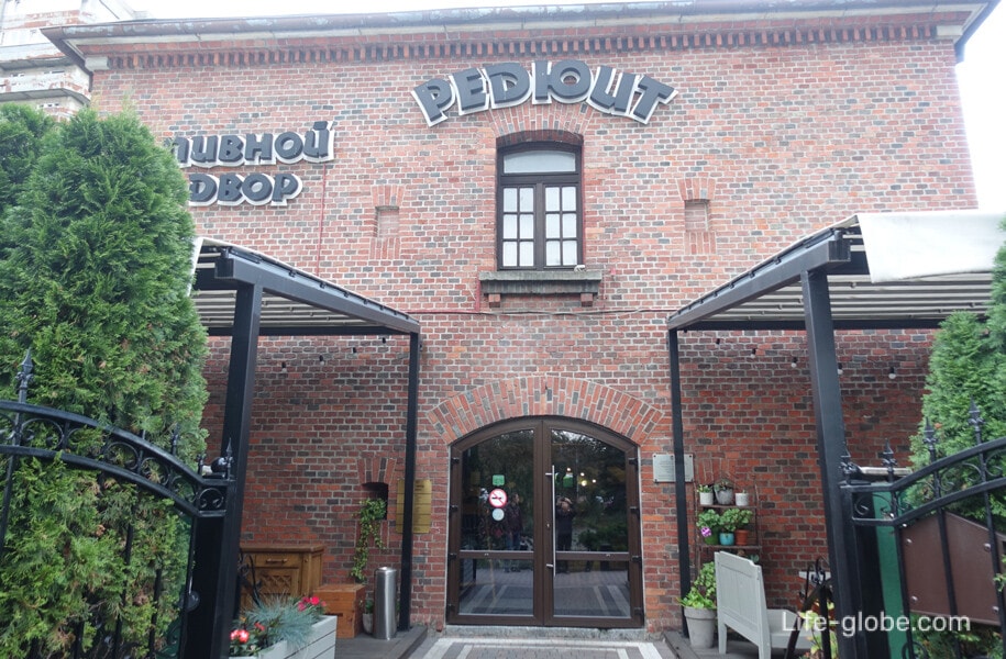
Reduit bastion "Kupferteich"
The Kupferteich bastion was built in 1859-1860.
The bastion got its name from the nearby Kupferteich reservoir (Kupferteich, translated as "Copper Pond").
The bastion consisted of: a two-tiered reduit, an earthen rampart, a wide water moat, and a glacis behind the moat. All fortifications with the exception of the reduit were demolished in the 1910s.
The reduit of the Kupferteich bastion (Reduit of the Kupferteich bastion) in plan is a two-story rectangular building with casemates. As a result of numerous reconstructions, the reduit acquired a "civilian appearance". Instead of the former embrasures, high windows with arched arches and window sills were pierced. The ceilings are made in the form of cross vaults. The former protective dirt embankment has been removed from the reduit, and the usual pitched roof has been made instead.
Currently, there is a restaurant-beer yard "Reduit" in the walls of the reduit bastion.
Address of the reduit of the Kupferteich bastion: 27 Litovsky Val Street.
Coordinates of the reduit of the Kupferteich bastion: 54°42'46"N (54.712833), 20°32'14"E (20.537417).

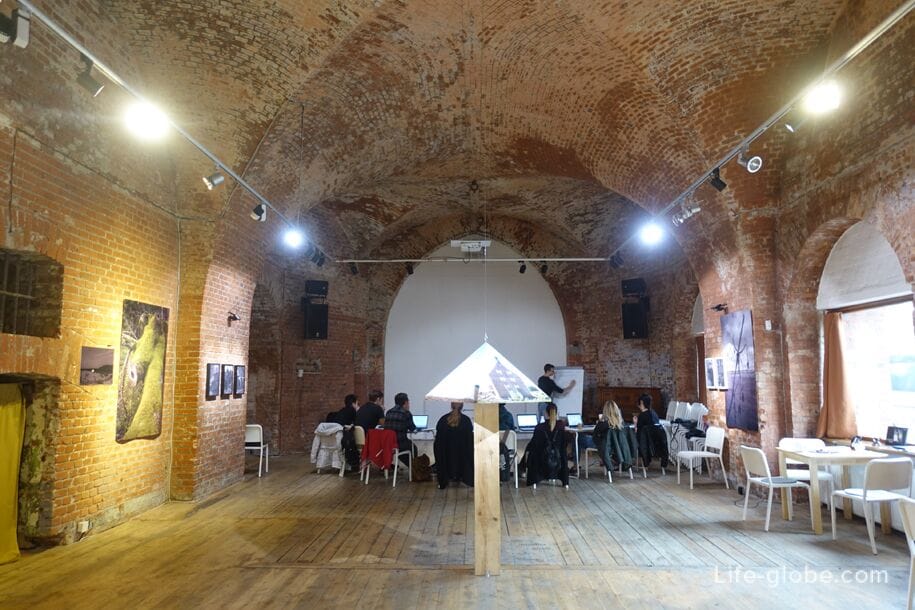
The Sackheimer Gate
Originally, the Sackheim Gate (Sackheimer Tor) was an integral part of the First fortification of Konigsberg (17th century).
In 1860-1865, the gate was rebuilt according to the project of Ernst Ludwig von Aster.
The Sackheimer Gate was probably the simplest of all the city gates of Konigsberg. They are made in the Neo-Gothic style, from the side of the city they were decorated with high reliefs of heroes of the Napoleonic Wars Johann David Ludwig York and Friedrich Wilhelm Bulow, from the outside - the image of a Black Eagle. The Order of the Black Eagle was considered the highest award of the Kingdom of Prussia.
Currently, there is a coffee shop and an art space "Gate" in the Sackheimer Gate, where exhibitions and various events are held.
Address of the Sackheimer Gate: Litovsky Val Street, 61 (intersection with Moskovsky Prospekt).
Coordinates of the Sackheimer Gate: 54°42'34"N (54.709588), 20°32'17"E (20.538258). Learn more about the Sackheimer Gate...
Reduit bastion "Lithuania"
Bastion "Litauen" (better known as bastion "Lithuania") It was built in 1843-1860 by Ernst Ludwig von Aster.
Initially, the bastion was a casemated coastal battery.
To date, only part of the bastion has been preserved - the reduit.
In the 1920s, a workshop for the production of sports boats functioned in the reduit of the bastion, and since the mid-1930s, a production for equipping marine torpedoes with explosives.
Today, the passage to the reduit is fenced and commercial premises are located there.
The address of the reduit of the bastion "Litauen": Litovsky Val street, 105.
Coordinates of the reduit of the bastion "Litauen": 54°42'23"N (54.706407), 20°32'20"E (20.538951).
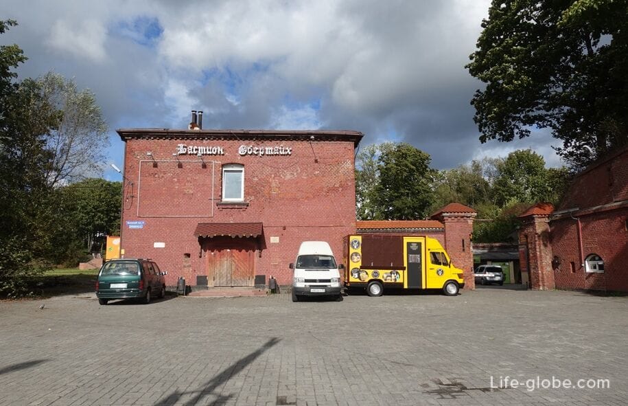
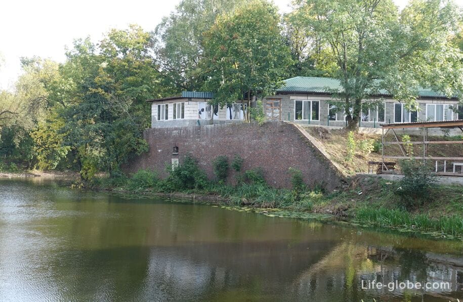
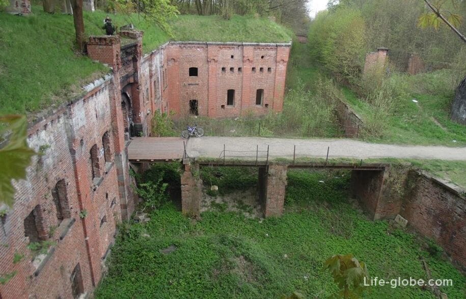
Reduit of the bastion "Pregel"
The Pregel bastion was built in 1851-1862 by architect I. Strauss. The bastion closed the eastern flank of the Haberberg front and covered the Pregel River, as well as the entrance to the city by land through the Friedland Gate, located near the bastion.
Initially, the bastion was an impressive fortification with moats, including internal ones.
In the early 1900s, the moats of the bastion were filled in, part of the roller bypass was dug, and only the reduit - the reduit of the bastion "Pregel" remained from the bastion.
Until 1945, the reduit was used as an ammunition depot, then the reduit premises were occupied by warehouses and some organizations.
Since 2015, the Night Wolves motorcycle club has been based on the territory of the reduit bastion, there is a cafe-bar and Fort Boyard.
The address of the reduit of the bastion "Pregel": Dzerzhinsky Street, 31.
Coordinates of the reduit of the bastion "Pregel": 54°41'45"N (54.696109), 20°31'26"E (20.523993). Read more about the reduit of the Pregel bastion...

Friedland Gate
The exact date of construction of the Friedland Gate (Friedländer Tor) is unknown, approximately 1857 - 1862(65) years.
The gates are built of red ceramic bricks in the Neo-Gothic style. The facade has a decorative design, including sandstone sculptures made by the Berlin sculptor V.L. Sturmer.
Currently, the museum "Friedland Gate" is located in the walls of the gate.
Address of the Friedland Gate: Dzerzhinsky Street, 30. The intersection of Kalinin Avenue and Dzerzhinsky Street, adjacent to the Yuzhny Park.
Coordinates of the Friedland Gate: 54°41'43"N (54.695378), 20°31'18"E (20.521678).
Ravelin "Friedland"
The Friedland Ravelin (auxiliary fortification) was built in the middle of the 19th century by Ernst Ludwig von Aster.
The Ravelin got its name because of its proximity to the Friedland Gate.
The ravelin was part of the Haberberg Front, connected by an embankment with the neighboring ravelin "Haberberg".
Now the ravelin consists of a reduit, a caponier and two half-caponiers. There are retail outlets on the territory of the ravelin.
Address of the Friedland ravelin: Kalinin Avenue, 4 (near the Yuzhny Park).
Coordinates of the ravelin "Friedland": 54°41'40"N (54.694640), 20°30'52"E (20.514686).

Ravelin "Haberberg"
The Haberberg Ravelin was, like the Friedland ravelin, built in the second half of the 19th century by Ernst Ludwig von Aster.
The ravelin got its name from the adjacent urban area of Konigsberg.
Now the Haberberg ravelin consists of a reduit, a caponier and two half-caponiers. It is an architectural monument of regional significance.
Address of the ravelin "Haberberg": Kalinin Avenue, 2 (near the Yuzhny Park).
Coordinates of the ravelin "Haberberg": 54°41'39"N (54.6944), 20°30'19"E (20.50535). More about Yuzhny Park...

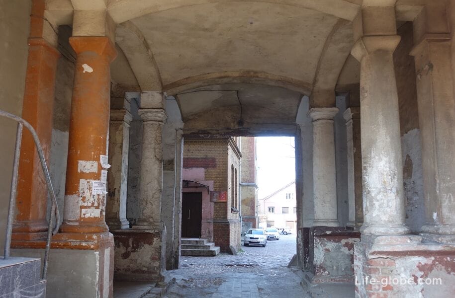
Quartermaster Barracks
The quartermaster barracks building was built in 1890.
The building is made of red brick. In architecture, there is a passage (passage) to the courtyard of the barracks and the courtyard itself.
The address of the quartermaster barracks building: Bogdan Khmelnitsky Street, 25.
Coordinates of the Quartermaster Barracks building: 54°41'49"N (54.697152), 20°30'17"E (20.504746). More about the quartermaster barracks building...
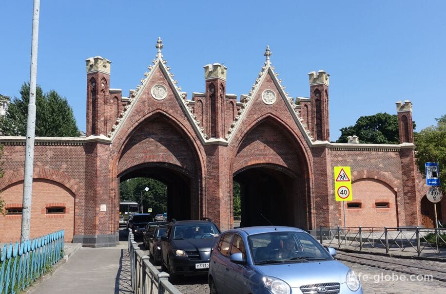
Brandenburg Gate
The Brandenburg Gate (Brandenburger Tor) is the only one of the gates still used for its intended purpose - the carriageway of Bagration Street passes through the gate.
The gate was built in Konigsberg in 1657.
In 1843, significant changes were made, as a result of which the Brandenburg Gate was almost rebuilt on the same site. Later, the gates were also subjected to reconstruction and restoration and maintenance work.
Now there is a marzipan shop-museum in the walls of the Brandenburg Gate.
Brandenburg Gate address: 137 Bagration Street. At the end of Bagration Street, at the beginning of Suvorov Street, within walking distance from the Southern Railway Station.
Coordinates of the Brandenburg Gate: 54°41'50"N (54.697281), 20°29'40"E (20.494642). Learn more about the Brandenburg Gate...
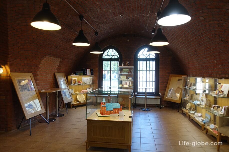
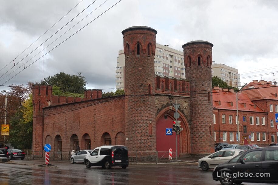
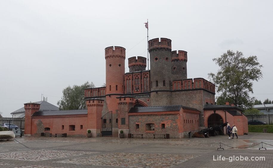
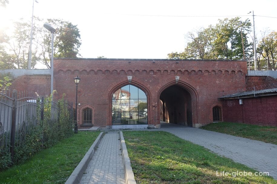
Friedrichsburg Gate
Friedrichsburg Fortress (later fort, now restored gate with museum exhibits) is a fortress, the construction of which as a citadel began in 1657.
In 1852-1858, the Friedrichsburg fortress was reconstructed into a fort of the same name (Fort Friedrichsburg / Fort Friedrichsburg or Feste Friedrichsburg), which became part of the Second Val Fortifications of Konigsberg. During the reconstruction, a brick gate was erected in Fort Friedrichsburg.
After the liquidation of the fort in 1916, auxiliary railway tracks were laid on its territory. By the decision of the Mayor of Konigsberg, the entrance gate of the fortress was preserved as an architectural monument, after which they also became known as the Friedrichsburg Gate.
By 1939, a two-story building was added to the north side of the Friedrichsburg Gate, and they themselves were used as the office of the freight station of the Imperial Railway.
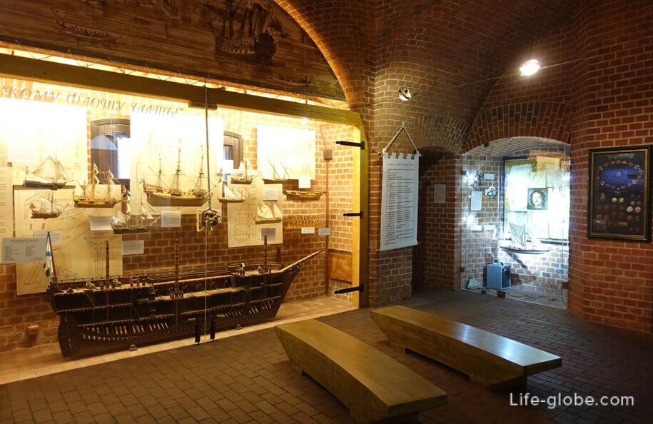
On May 27, 2011, the historical and cultural center "Ship Resurrection" was opened in the renovated premises of the gate and on the adjacent territory, which functions as a museum to this day.
The address of the gates of the Friedrichsburg fortress: 39 Portovaya Street. On the south side of the Pregolya River, near the Two-tier Bridge and the Peter the Great Embankment.
Coordinates of the gates of the Friedrichsburg Fortress: 54°42'17"N (54.704763), 20°29'38"E (20.494014).
Railway gates
The railway gate (Eisenbahnhof Tor) was built in 1866-1869 by architect Ludwig von Aster.
The railway leading to Pillau (now the city of Baltiysk) passed through the gate.
The railway gates have two spans decorated with pointed arches. The southern span was built in 1866, and the northern one in 1889. On the sides of the arches were casemates with embrasures.
In the post-war years, the railway line passing through the gate was not used, the rails were removed in the late 1990s.
Currently , the gates are:
- Kaliningrad Planetarium named after F.V. Bessel;
- exhibition of historical miniatures "Parade of Tin Soldiers", including: miniature sculptures and reconstructions of historical battles of different eras.
The address of the Railway gate: Guards Avenue, 51A.
Coordinates of the Railway gate: 54°42'36"N (54.710188), 20°29'25"E (20.490550). Learn more about Railway Gates...
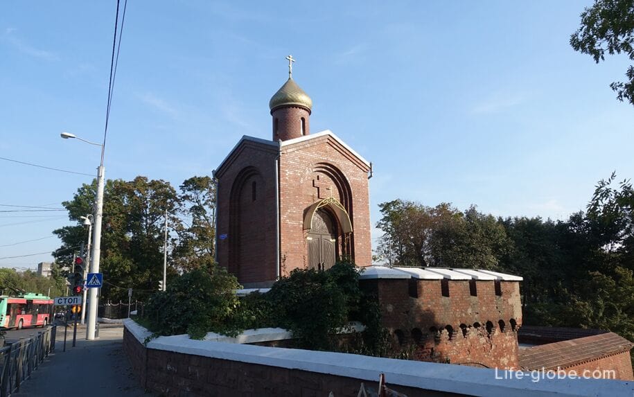
The Ausfalian Gate
The Ausfal Gate (Ausfalstor Tor) was built approximately in 1626.
In 1866, the gate was rebuilt by architect Ludwig von Aster.
The gate, built in the style of brick Gothic, was pedestrian. Initially, they crashed into the shaft and were below ground level, had one passage (tunnel), to which a ladder and a bridge led from the outside, and a combat platform with a crenellated parapet was located above the passage. Casemates with embrasures of frontal and flanking fire were located on the sides of the passage.
In 1993-95, the Orthodox chapel of St. George the Victorious was built on the upper platform of the Ausfalsky Gate, designed for combat, located at the level of the roadway of the Guards Avenue.
Currently, what remains of the Ausfalsky Gate can be seen below the level of the streets of Field Marshal Rumyantsev and Guards Avenue.
Coordinates of the Ausfalian Gate: 54°42'44"N (54.712327), 20°29'25"E (20.490487). Learn more about the Ausfalian Gate...
Reduit bastion "Astronomical"
Bastion "Astronomical" (bastion Sternwarte - bastion Observatory) it was built in 1856 - 1862.
In 1910, the earthen rampart of the bastion, together with the caponiers, was demolished, and a railway was laid instead of the former water fortress moat.
From the bastion remained (and still exists) only the inner part is the reduit of the bastion "Astronomical (Reduit of the Astronomical bastion) - a semicircular two-story structure with a powerful brick vault.
Currently, the reduit has a courtyard. Its premises are used for commercial purposes.
The address of the reduit of the bastion "Astronomical": Guards Avenue, 22.
Coordinates of the reduit of the bastion "Astronomical": 54°42'48"N (54.713423), 20°29'24"E (20.490175). More about the reduit of the Astronomical Bastion…
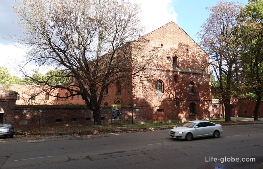
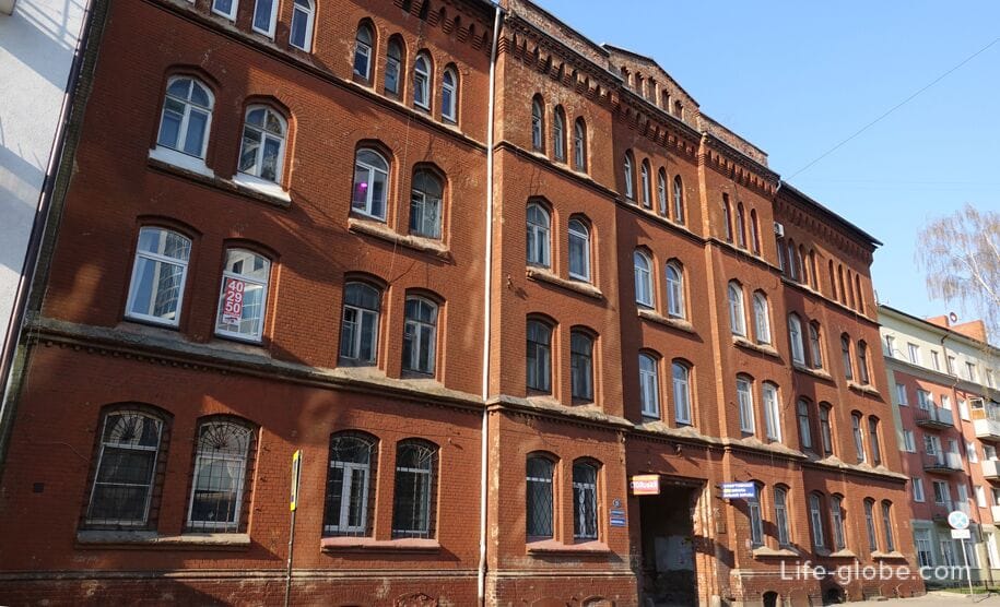
Barracks of the Wrangel Cuirassier Regiment
The building of the barracks of the 3rd Cuirassier Count Wrangel Regiment or barracks of the Wrangel Cuirassier Regiment was built on Wrangelstrasse in 1870.
In 1927, the authorities of Koenigsberg purchased an empty barracks building from the military department, after which the central part of the barracks was dismantled, in its place lay Zitzelinstrasse (now part of Proletarskaya Street). The Bismarck Lyceum was located in the west wing of the barracks, and the Herder Folk eight-year school was located in the east.
During the fighting in April 1945, the western part of the barracks burned down and was later dismantled into bricks. The eastern part of the building has survived and has been preserved to this day. Now the premises in the walls of the former barracks are rented out.
Address of the barracks of the Wrangel Cuirassier Regiment: 90-92 Proletarskaya Street.
Coordinates of the barracks of the Wrangel Cuirassier Regiment: 54°43'14"N (54.720731), 20°30'53"E (20.514934). Learn more about the barracks...
Forts
For two decades, starting in 1872, a defensive line with a length of 43 kilometers was erected on the approaches to the city, which was a ring of 12 main and 3 auxiliary (smaller) forts, each of which had its own names.
In the future, the forts were repeatedly modernized, but by the time of the assault on Konigsberg in 1945, they had lost most of their defenses.
To date, most of the forts are closed and (or) are in an abandoned state.
The most interesting to visit and well-preserved of the forts are:
- Fort No. 11 "Denhoff" (Fort XI Dönhoff), built in 1877-1882. The fort covered the railway to Insterburg.
The fort is an elongated hexagon at the front, surrounded by a water moat. The central structure is protected by an earthen embankment. The interior rooms and two courtyards are symmetrically located relative to the central tower.
Currently, the fort and its territory function as a museum complex with exhibitions.
The address of the fort "Denhof": Energetikov Street.
Coordinates of the fort "Denhof": 54°39'24"N (54.656781), 20°34'4"E (20.568053). Learn more about Fort No. 11 and the museum...
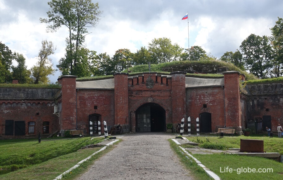

- Fort No. 5 "King Friedrich Wilhelm III" (Fort V King Fried Wilhelm III), finally built in 1886, when the fort was additionally reinforced with a reinforced concrete coating about 2 meters thick and an observation rotating armored dome was built.
The fort has the shape of an elongated hexagon along the front with a length of 215 meters and a width of 105 meters, surrounded by a water moat with a width of 21 meters and a depth of 5 meters. The two-storey central structure with symmetrically arranged internal rooms on both sides of the central tower is covered with an earthen embankment.
Now Fort No. 5 is a free-standing exposition of the Kaliningrad regional Historical and Art Museum, as well as a monument of defensive architecture and a military-historical memorial complex.
It functions as a museum where you can visit inside the fort, get acquainted with the history of the creation of the fort belt, and view the exhibition of military equipment.
The address of the fort "King Friedrich-Wilhelm III": Bulatov Street (landmark sign "Kaliningrad" at the entrance to the city).
Coordinates of the fort "King Frederick William III": 54°45'9" (54.752525) S.sh., 20°26'35" (20.443236) V.D.
- Fort No. 3 "King Friedrich III" (Fort III King Friedrich III), built in 1879.
This is the first and largest fort of Konigsberg. He covered the railway lines to Tilsit and Kranz, the highway to Kranz.
The fort is a 360-by-180-meter hexagon elongated along the front, surrounded by a dry moat 10-11 meters wide and up to 6 meters deep.
In the post-war years, Fort No. 3 was used as a depot for ammunition and military equipment, since the mid-1990s it has not been used.
Today, access to the territory of Fort No. 3 is closed, according to the sign - reconstruction works are underway.
The address of Fort No. 3: 232 Alexander Nevsky Street.
Coordinates of the fort № 3: 54°45'41"N (54.761561), 20°32'48"E (20.546791).

Map diagram of the recommended route "Kaliningrad fortification"
The route is designed for two days. The main objects are highlighted.


