


The Curonian Spit is a national park, the territory of which belongs to two states: Russia and Lithuania.
Full official name: National Park "Curonian Spit".
The Curonian Spit is included in the UNESCO World Heritage List.
The total length of the Curonian Spit is 98 kilometers, of which about 48 kilometers (the southwestern part of the spit) belongs to Russia (the Kaliningrad region) and 50 kilometers to Lithuania.
This article will focus on the attraction of the Curonian Spit of Russia, which is located in the Zelenograd district of the Kaliningrad region. The nearest resort town to the spit is Zelenogradsk.
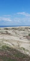
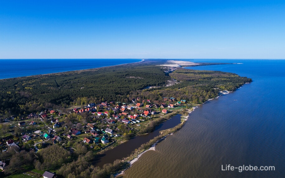
The Curonian Spit is a long and narrow (the width of the spit varies from 350 meters to 3.8 kilometers) saber-shaped strip of land, which is washed from the east by the freshwater Curonian Bay, and from the west by the salty Baltic Sea.
The narrow strip of land between the sea and the bay presents a variety of diverse and changeable natural ecosystems: dunes, sandy beaches of the sea and the bay, lakes, meadows, swamps, as well as spruce, pine and deciduous forests.
In addition to natural attractions on the Curonian Spit, there are lighthouses, equipped beaches and three small residential villages (Lesnoy, Rybachy and Morskoye), where cafes, shops are located and there are accommodation facilities (hotels, apartments, houses, recreation centers). All accommodation facilities on the Curonian Spit can be viewed and booked here

Sights of the Curonian Spit, Kaliningrad region
The main attractions of the Curonian Spit are natural, some of which were created by the efforts of people, but, one way or another, they are still natural objects.
Curonian Lagoon and the Baltic Sea
The freshwater Curonian Lagoon and the salty Baltic Sea, washing the spit on both sides, are already attractions in themselves.
The Curonian Lagoon is a lagoon in the shape of a triangle. The average depth of the bay is 3.7 meters. In its wide southern part there are extensive depressions up to 6 meters deep, and in the northern part - depths do not exceed 2 meters. The amount of water that flows from the rivers to the bay per year is 3.5 times higher than its total volume. The water level in the bay is on average 12 centimeters higher than in the sea. Fresh water from the bay constantly flows through a narrow strait into the Baltic Sea.
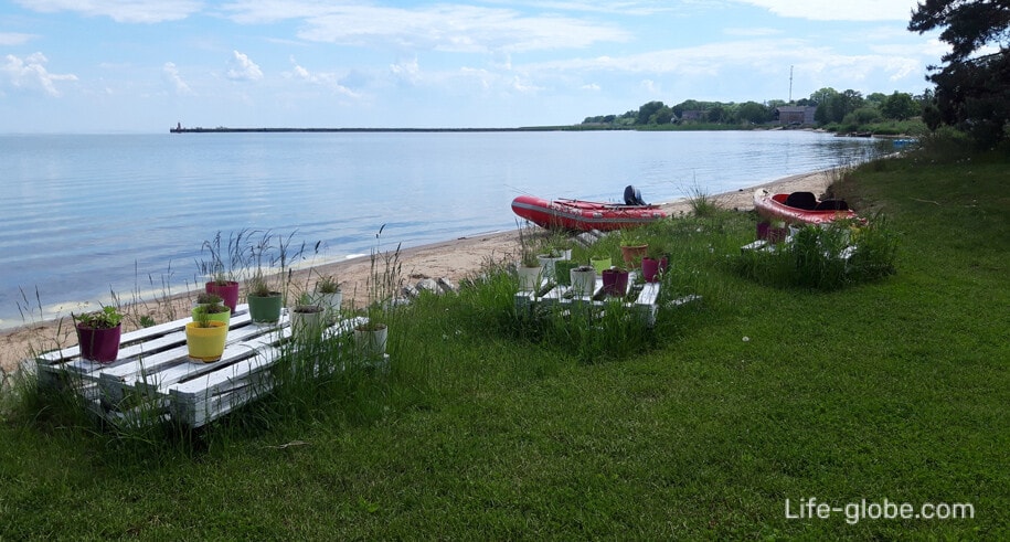
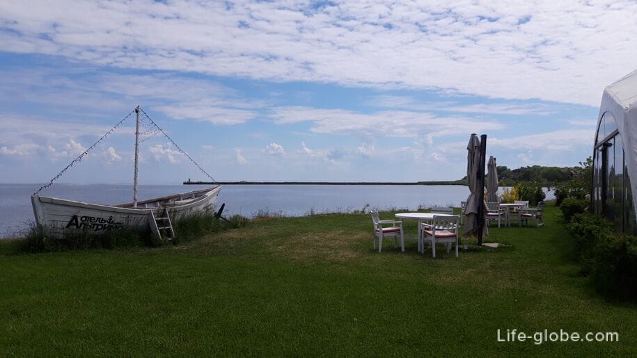
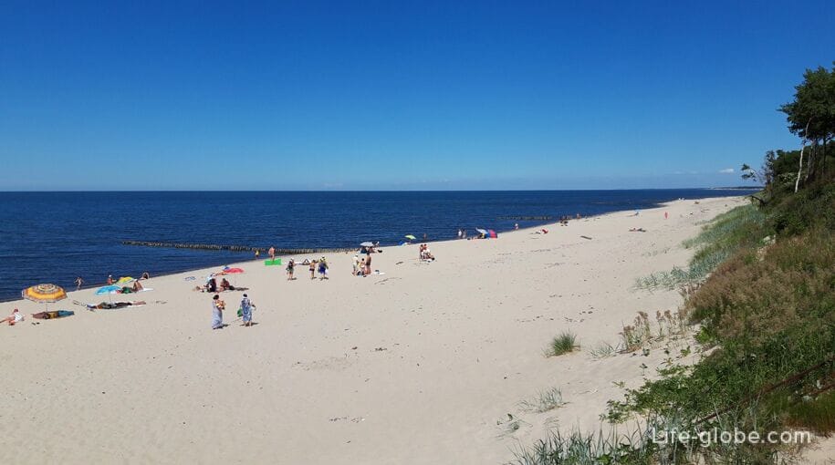
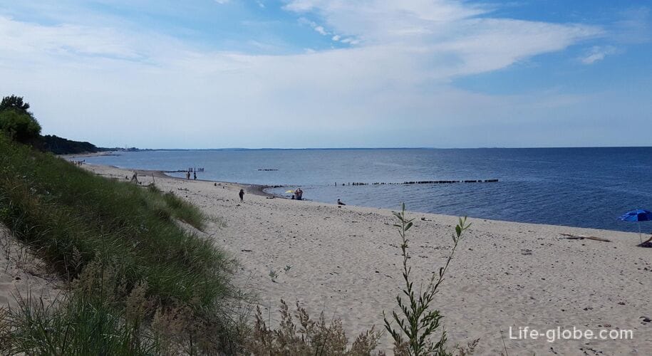
Both on the coast of the sea and the bay there are beaches.
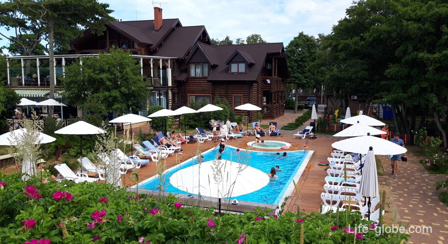
The water in the bay is warmer and warms up faster than the sea. Swimming in the bay begins in June. There are practically no beaches in the bay, since the soils here are mostly swampy. From the territory of some hotels in kosa there are exits to the bay, where small beach areas are equipped; for example, this is the Altrimo hotel in the village of Rybachy
An asphalt road runs along the entire Curonian Spit, which is convenient for movement.
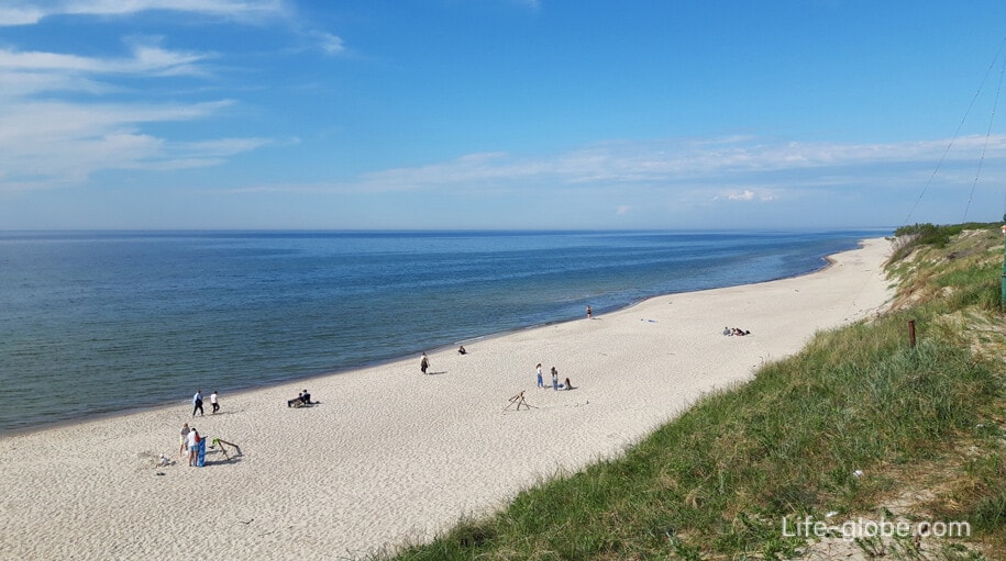
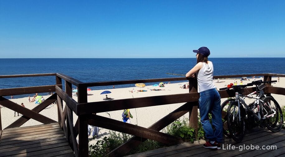
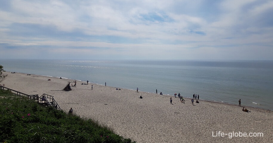
You can get to the coast of the Baltic Sea, which is a long sandy spit, from the road along the trails. There are quite a lot of exits.
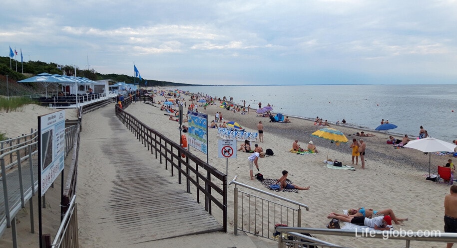
In the village of Lesnoy on the Baltic Sea there is an official beach with beach infrastructure and a promenade is equipped.
In the village of Lesnoy, near the seashore, there is a 3-star Mayakovsky hotel with direct access to the promenade and the beach.
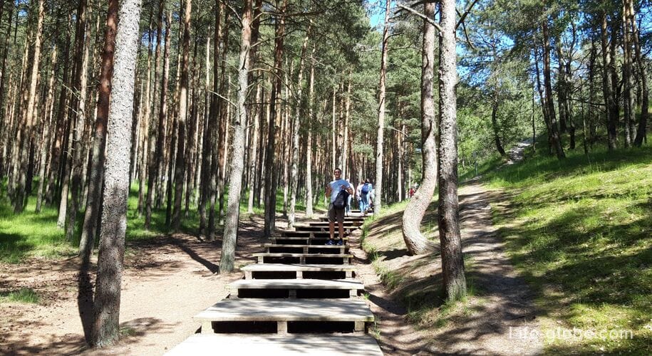
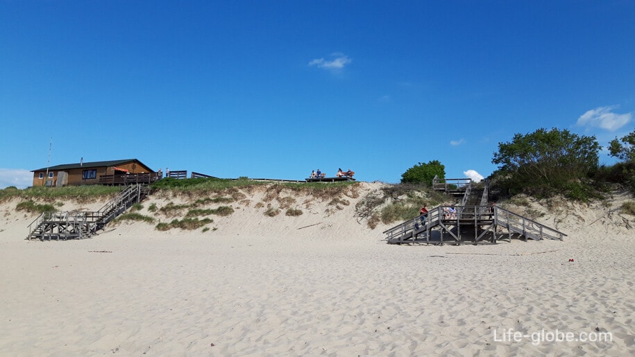
In any place of the Curonian Spit, in order to reach the Baltic Sea, it is necessary to overcome a sand wall that resembles a protective wall and protects the rest of the peninsula from storm waves and a constantly blowing westerly wind - this is avandyuna.
Wooden stairs are equipped from the avanduna to the coast.
Avanduna is not an entirely natural formation. It was systematically created for many years, starting in 1803, on the site of natural coastal beach dunes, some of which were part of the modern avandune.
Today, the avandune has a different width - from 10 to 70 meters and a height - from 3 to 12 meters.
Its sea windward slope is steep, short, smooth, and sometimes stepped. The leeward, "inner" slope of the avandune is more gentle, long and wavy.
The avandyuna was created as follows: about 50-60 meters from the water's edge, pegs about 70 centimeters high were driven into the sand in two rows. When the space between them was filled with sand, the second row of barriers began to be driven in from above. In autumn, the formed shaft was planted with grasses that bind the sand and are not afraid of sand drifts. The grass entwined the sand with a dense network of shoots and roots, preventing it from blowing out. After two or three years, willow and other shrubs were planted in the resulting substrate.

Royal Forest
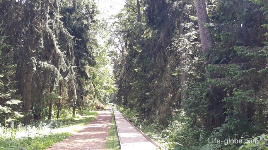
The Royal Forest is a hiking route that passes through centuries-old coniferous trees, some of which were silent witnesses of royal hunts taking place on the spit since the 16th century.
The walking route "Royal Forest" is laid between the highway and the Curonian Lagoon. It passes through coniferous forests and old stands of introduced trees,including giant thuja. The route has an exit to the shore of the Curonian Lagoon, and part of the route passes along the section of the ancient postal route, which was the main road from East Prussia to Russia for a hundred and fifty years.
There is an observation deck along the route near the bay.
The length of the route is 2.9 kilometers. The route is located on the 6-6. 5 kilometer of the spit, from the coast of the Curonian Lagoon.
Coordinates of the beginning of the route: 54°59'20.4" N 20°33'36.8" E (54.988996, 20.560211).
Visiting the route is free (free of charge).
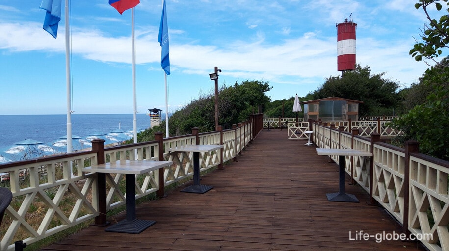
On the opposite side of the roadway from the Royal Forest there is an observation deck and a staircase leading to the sandy coast of the Baltic Sea. Learn more about the route "Royal Forest", the observation deck and the exit to the sea coast...

The village of Lesnoy
Lesnoy is the first village of the Curonian Spit, where the narrowest point of the spit is located (350 meters).
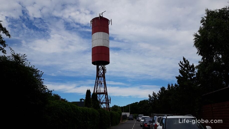
The main attractions of the village are: the temple of Panteleimon the Healer and the lighthouse near the Baltic Sea.
The temple was built in memory of the lost fishermen. The Curonian Lagoon has a changeable disposition. If the wind blows from the sea, then the calm at the coastline is replaced by a storm at a distance of 300-400 meters from the shore, and the wringing wind turned even fishing boats into a toy. And in winter, a torn ice solder carried hundreds of fishermen into the bubbling bay. Not everyone managed to escape. The names of the dead fishermen are sometimes heard at services in this church in their memory and in the realization that they do not joke with the elements.

The lighthouse was installed on the seashore in 1982 and visually represents a large white-red "barrel" standing on four iron "legs", 40 meters high.
The former lighthouse in Lesnoye was washed away by a January storm in 1975, tilted and was dismantled. Now its concrete base can be seen on the beach near the promenade.
Access to the structure of the lighthouse is closed, since it is a navigation sign and carries a radio and a light beacon, the signal of which is visible in the sea and bay at a distance of up to 17 miles. Cellular repeater antennas are installed on the lighthouse.
Since sometimes in the dark the beam of the lighthouse picks out the silhouettes of couples in love on the coast, the lighthouse in Lesnoye is popularly called the "Floor Lamp of Love". Learn more about the village of Lesnoy...
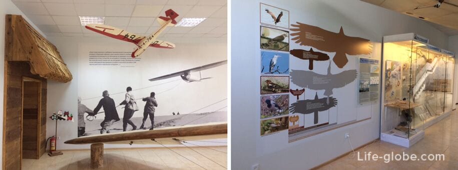
Visit center "Museum complex"
The visit center "Museum Complex" is a complex on the territory of which there are:
1. A visit center where you can buy advertising and souvenir products.
The exhibition presents: hall of nature, which tells about the history of the formation of the spit and the formation of its landscape, nature, fauna and flora, nature conservation and sandy disaster on the spit; hall of the history of the fishery, about the life and the traditional occupations of the population of the Curonian spit; hall "Wings over the Curonian spit", is devoted to ornithology, the activities of the biological Station of the Zoological Institute of the Russian Academy of Sciences and the history of gliding in the Curonian spit.
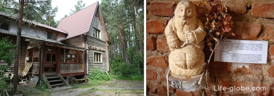
2. An original wooden structure, which houses a private "Museum of Russian Superstitions" dedicated to Russian folklore: the spirits of the Slavs, characters from fairy tales and various folk beliefs.
In the museum, Baba-Yaga, Kikimora, Leshii, forest, domestic, field, water, road night and other spirits are carved out of wood, which in the old days could help and harm a person. There is also a collection "Fellow Countrymen", dedicated to the bright representatives of the local population who lived in this territory at different times.
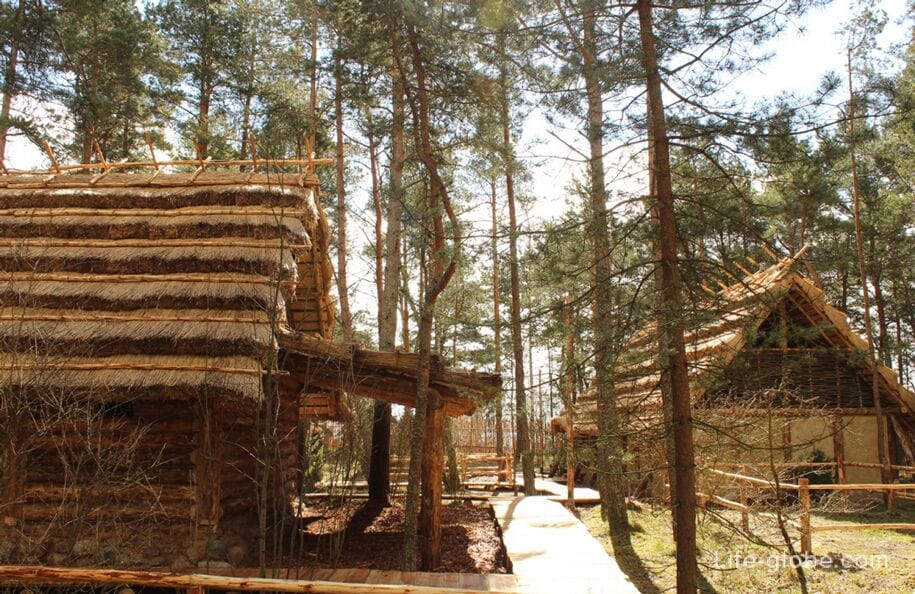
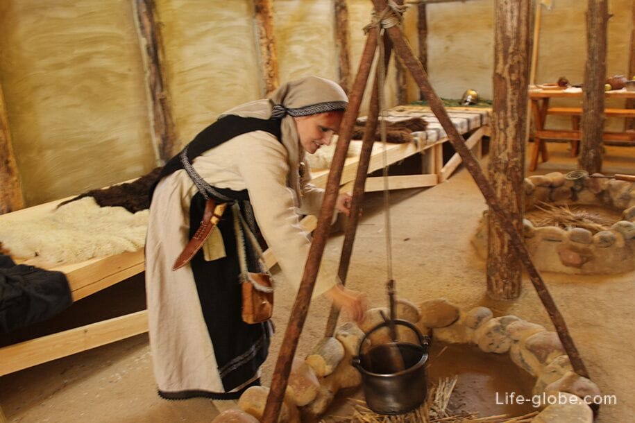
3. The open-air Museum "Ancient Sambia", where visitors will get acquainted with the traditional culture, lifestyle and costumes of the Baltic peoples in the Viking age.
The visit is paid.
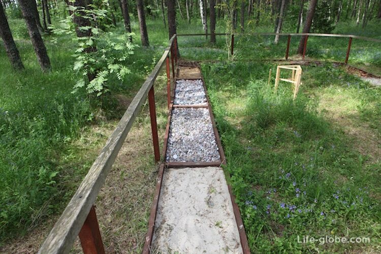
In addition, the "Trail of Sensations" is open on the territory of the museum complex, which is an unusual way to get acquainted with the landscapes of the Curonian Spit, for which visitors need to take off their shoes and walk through the variety of reliefs of the Curonian Spit with their eyes closed.
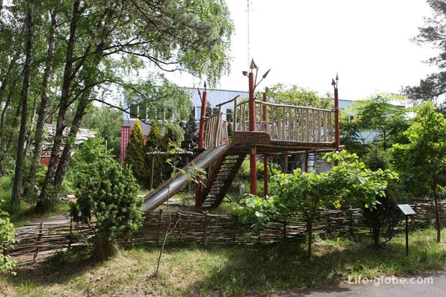
There is also a playground for children on site. In summer, on fine days, boat trips "Chaika" are held on the Curonian Lagoon.
The visit center "Museum Complex" is located on the 14.7 kilometer of the Curonian Spit, from the coast of the Curonian Gulf.
The complex offers guided tours.
More information about the complex: facilities, opening hours, conditions and cost of visits - park-kosa.ru/vizit-czentr.
Fringilla Bird Banding Station
Fringilla is a field stationary Biostation of the Zoological Institute of the Russian Academy of Sciences, which is a division of the world's first ornithological station, founded in Rossitten (now the village of Rybachy) in 1901 by Professor I. Tinneman.
The hospital received its name in honor of the finch bird (in Latin, "fringilla").
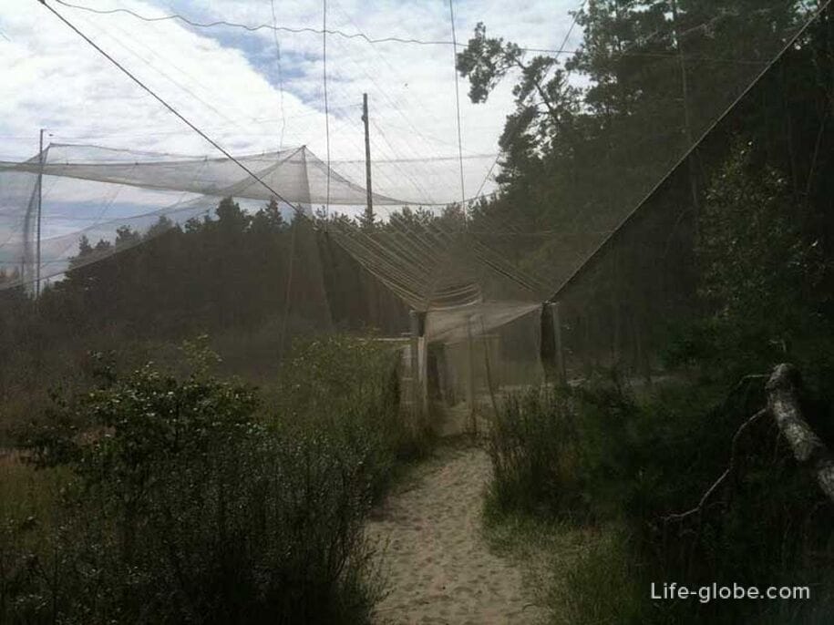
The Fringilla station operates seasonally, since in autumn and spring millions of birds fly over the Curonian Spit National Park, which are sent to the warm countries of Southern Europe and Africa. It is at this time that the station employees set up huge nets for catching birds, registering and banding.
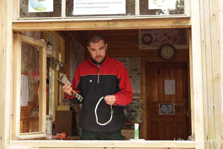
Today, a 500-meter route runs through the territory of the field hospital. Fishing traps of the Rybachinsky type for catching birds and banding are installed on the territory. The tour is conducted by qualified specialists-ornithologists (the visit is paid).
The route is located on the 23rd kilometer of the spit, from the Curonian Lagoon.
Coordinates of the beginning of the route: 55°05'21.9"N 20°43'55.6"E (55.089428, 20.732110).
Rybachy Village
The village of Rybachy (until 1946 - Rossitten) is the central settlement of the Curonian Spit and is located in the widest part of the Russian part of the spit, with the Rybachinsky Cape protruding into the bay, which was formed when an ancient Moraine island was incorporated into the sandy body of the spit, composed of clay deposits with boulders and pebbles (i.e. moraine).
At this place in the 14th century, the knights of the Teutonic Order founded the settlement of Rossitten and built a castle, which lasted until the middle of the 16th century.
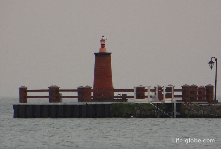
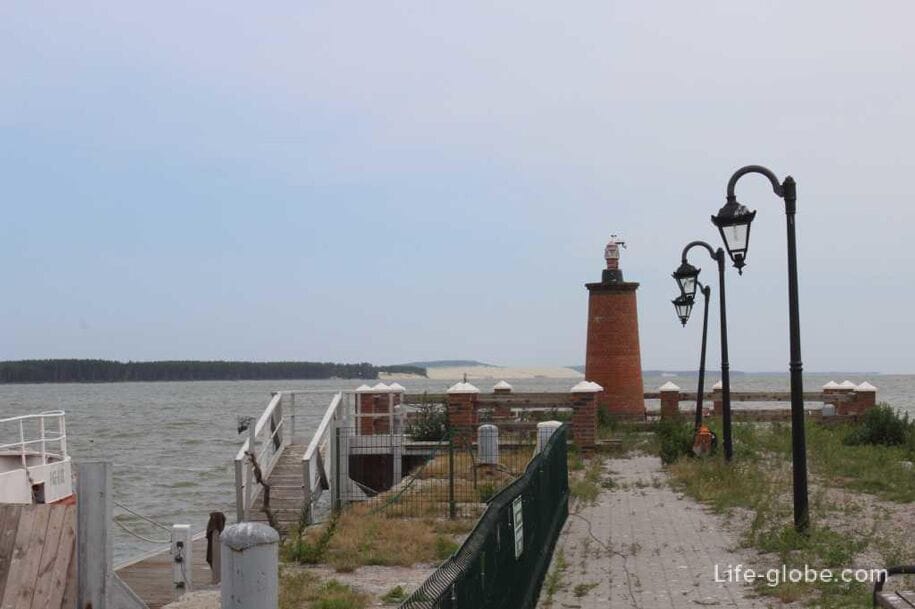
There is a lighthouse near the Curonian Lagoon in Rybachy . The first lighthouse was built in 1884 on the site of the old Order castle and was a round stone tower, to which the lighthouse keeper's house was directly adjacent. In early February 1945, the lighthouse was blown up by German sappers during the retreat of German troops.
The new lighthouse in the village was built in 1950 and is located in the vicinity of the village on the Chernaya dune, at an altitude of 33 meters. The height of the lighthouse itself is 24 meters. The range of visibility of the fire is 18 miles. The lighthouse tower is a narrow four-sided truncated pyramid with a platform on which the lighthouse emitter is located. The upper part of the lighthouse tower is painted red, and the lower part is white.
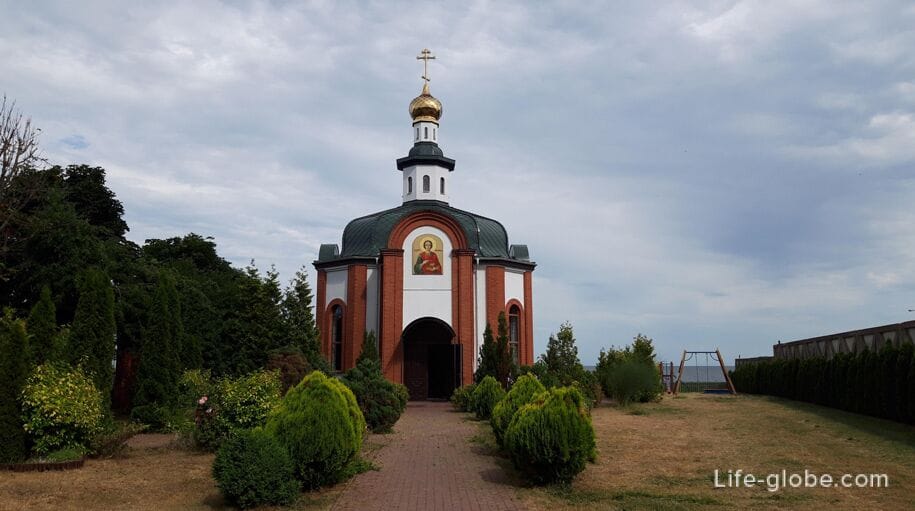
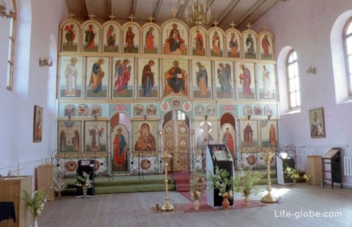
Also, one of the main attractions of the village is the church of St. Sergius of Radonezh.
In the sixties of the 19th century, the Lutheran community of the village of Rossitten decided to build a new church, which was founded in 1872 and was built in the pseudo-Romanesque style according to the project of the famous royal architect August Stüler. The construction of the church was completed by the architect Tischler in 1873.
After 1945, a flour milling shop was located in the building of the former church for some time, later-a workshop for repairing the nets of the local fish farm.
In 1992, the building was transferred to the Orthodox community of the village of Rybachy. It was consecrated on October 8, 1992 in honor of St. Sergius of Radonezh. The iconostasis was made by the masters of the Tver school of icon painting by Andrey Zaprudny in 1992-1993.

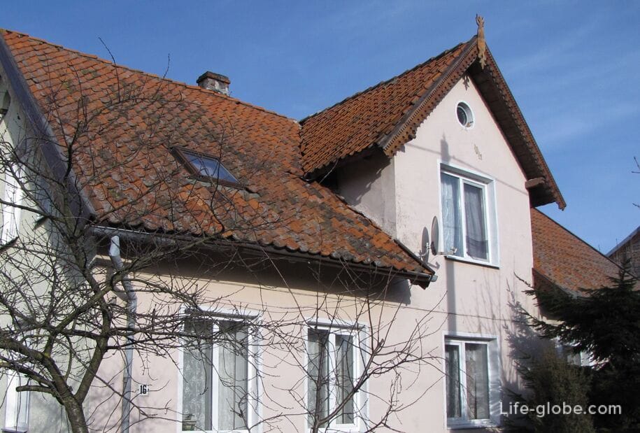
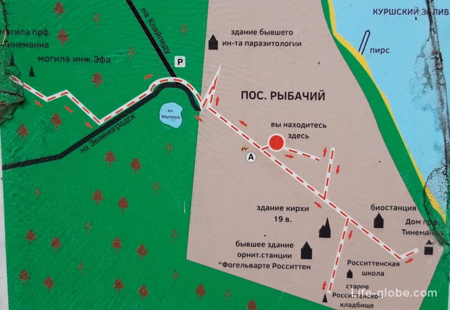
The walking route "from Rossitten to Rybachy" runs through the village, which introduces the architecture and history of the village, as well as its famous residents who were engaged in scientific activities on the territory of the peninsula and made a significant contribution to the popularization of the spit and turning it into a resort.
During the tour you can see thepier in the Curonian lagoon; the Church of the 19th century; the house of Professor Tirimanna, the founder of the world's first ornithological station; the former rosettenstein school; the homes and buildings of the early 20th century; the old German cemetery; the grave of Professor Johannes Tirimanna and dune inspector Franz Wilhelm of EFA made a great contribution to the preservation and strengthening of the villages moving dune Sands.
The length of the route is 3.8 kilometers. Information boards are placed along the route.
Map-scheme of the route "from Rossitten to Rybachy"
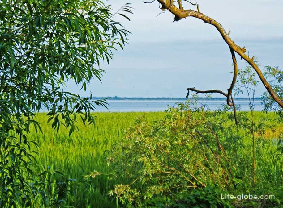
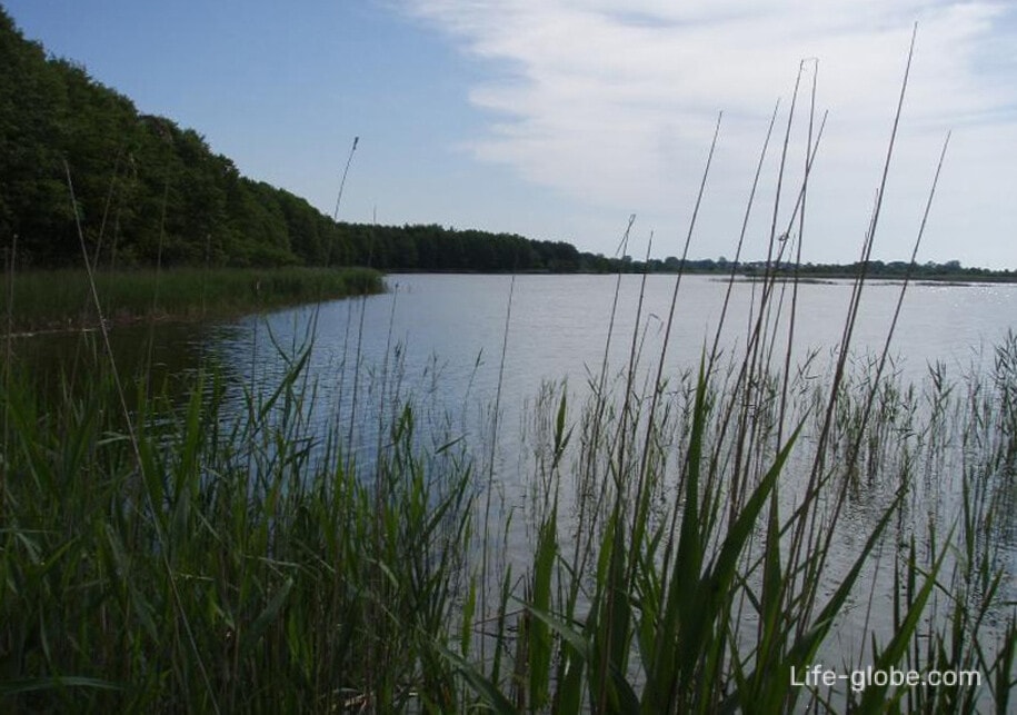
Lake Chaika
Lake Chaika is located near Rybachy and is the largest lake of the Curonian Spit.
Lake gulls nested on the lake, so the lake received the German name Mevenbruch (Gull Swamp). From April to May, the Gulls laid eggs, and in the autumn they flew away together with the young for the winter. Ornithologists at the beginning of the 20th century ringed lake gulls right in their nests, and also collected eggs for sale.
Today, Lake Chaika is a semi-closed forest lake with thickets of reeds and cattails. The bottom of the lake is covered with silt, which comes to the surface near the western swampy shore in dry years. In the eastern part of the lake, the thickness of the silt layer decreases, sometimes exposing sand.
The lake is rich in fish. There are viewing platforms on the lake.
Lake Chaika is located on the 32nd kilometer of the spit.
Coordinates of Lake Chaika: 55°09'03.3"N 20°49'14.4"E (55.150929, 20.820655).
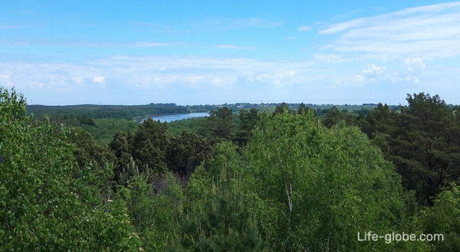
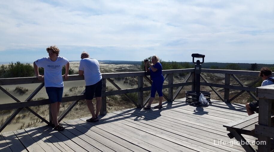
Muller Height (Steep Dune)
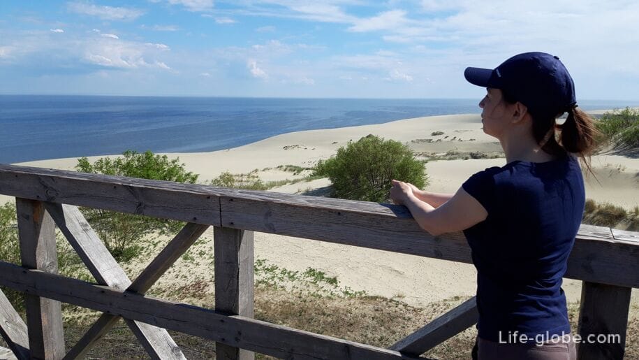
The Muller height is the highest point of the "Steep" dune (or Marsh dune, German name: Bruchberg) of the Curonian Spit, where the observation deck is located.
The height was named "Muller" in honor of the forester of the Konigsberg Forest Department, Ludwig Muller, who studied forest soils and introduced a new method of forest planting, which allowed fixing moving sands.
The height of the Muller is a public ecological trail with a length of 2 kilometers, which runs on a 32.1 kilometer spit, near the village of Rybachy.
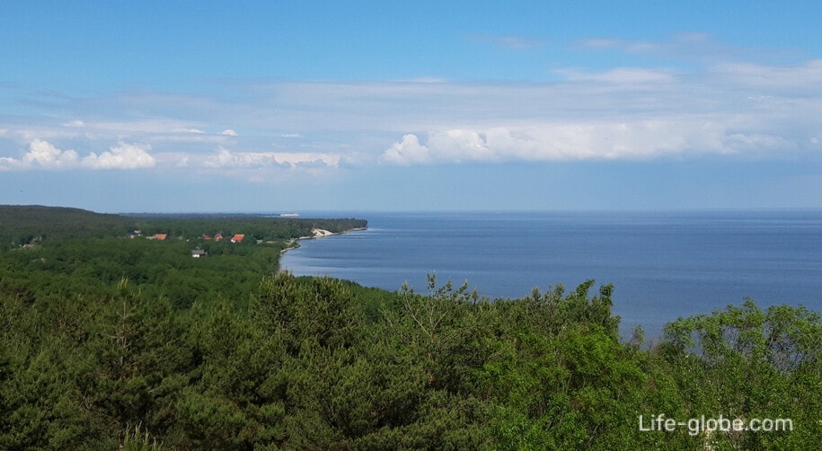
From the observation deck of the Muller Height, you can enjoy panoramic views of the forest areas of the spit, the Baltic Sea, the Curonian Lagoon, Lake Chaika and the village of Rybachy.
Visits to the route and the observation deck are free (free of charge). Learn more about the Mueller height…


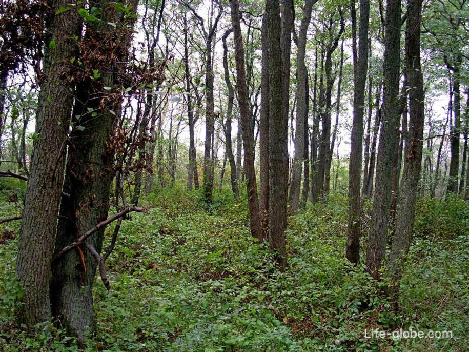
Rossitten Forest
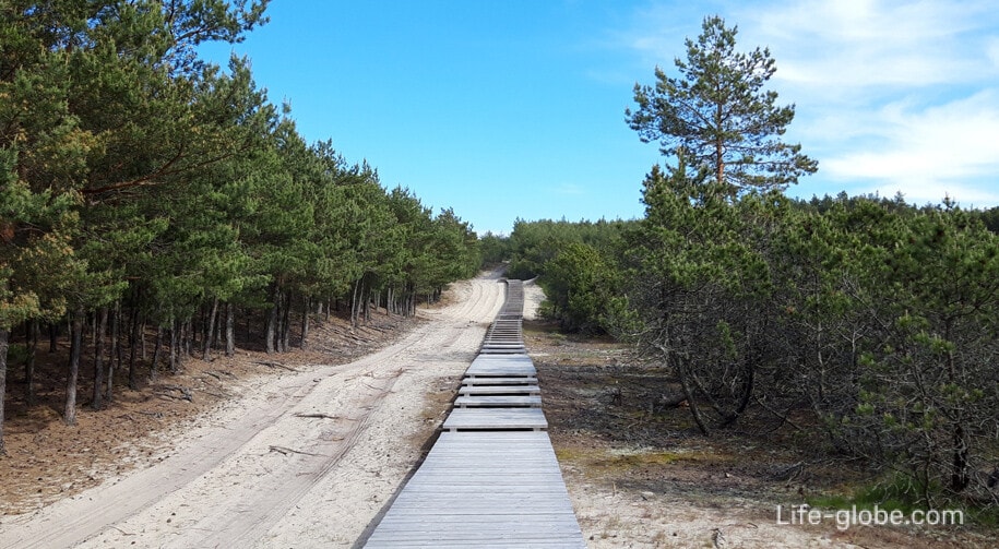
The Rossitten Forest ecological trail runs through the territory of the Golden Dunes district forestry, along a flat forest clearing and a dirt road towards the Baltic Sea.
In a mixed (pine-birch forest with oak and spruce, in the undergrowth - with mountain ash) forest, visitors can meet various of its inhabitants: birds, wild boar, roe deer, fox, raccoon dog and even elk, or see traces of their vital activity. For example, numerous poroi, lying down, and so on.
The route is equippedwith: access to the Baltic Sea beach and an observation deck with a height of 6 meters. At the end of the route, by the sea, there is a cafe.
The length of the route is 2 kilometers. The route is located near the village of Rybachy, on the 34th kilometer of the spit, from the Baltic Sea.
Coordinates: the beginning of the route is 55°09'33.9"N 20°50'32.1"E (55.159425, 20.842255), the end of the route is 55°09'50.9"N 20°48'57.9"E (55.164132, 20.816077).
Visiting the route is free (free of charge).
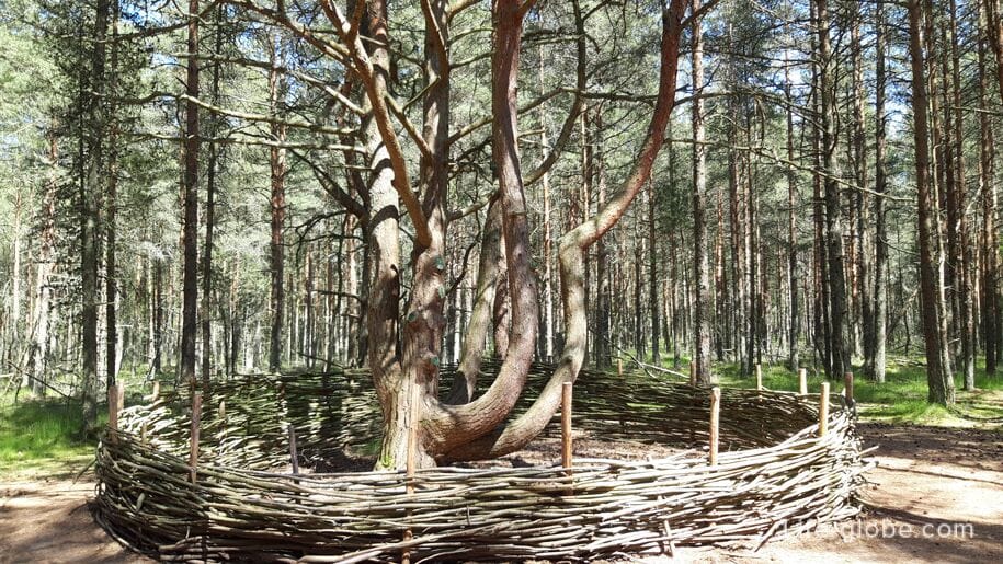
Dancing Forest
The dancing Forest is one of the most famous and visited natural attractions of the Curonian Spit of the Kaliningrad region.
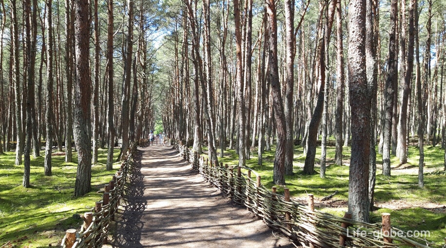
The dancing forest is an ecological trail (hiking route), 800 meters long, which runs along the part of the Curonian Spit - on the 37th kilometer of the spit, 4 kilometers north of the village of Rybachy.
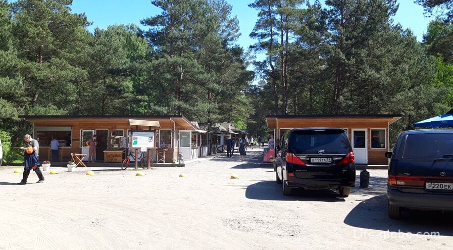
There is a parking lot near the route, there are souvenir shops and cafes.
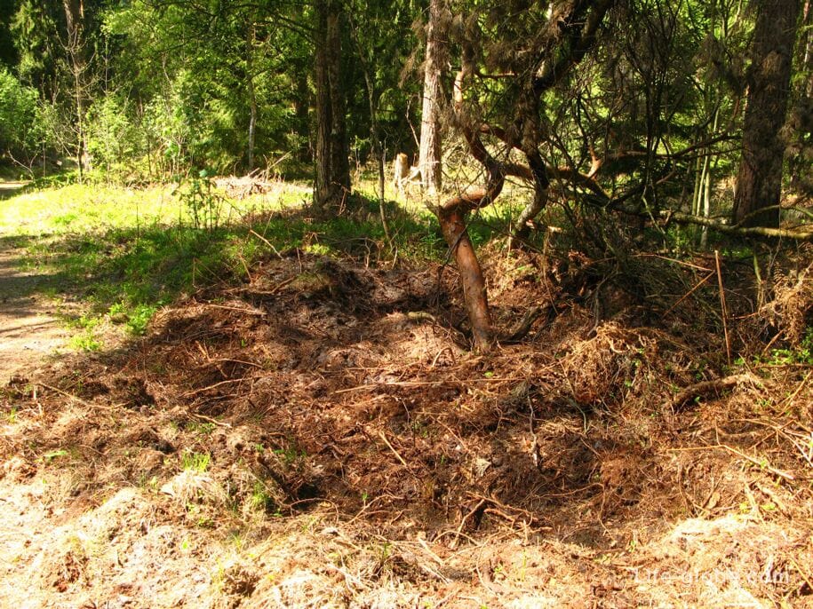
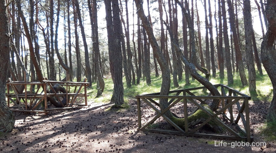
The dancing forest is a coniferous forest, the tree trunks of which are quite thin and loop in bizarre zigzags, and several trees have trunks of a "twisted" shape at all. For this reason, the forest was called "Dancing".
The route introduces guests to an unusual section of pine forest planted in the early 60s of the 20th century on the Round Dune (German name: Runderberg-Round Mountain), to strengthen the sands of the Curonian Spit.
Visiting the route is free (free of charge). Learn more about the "Dancing Forest" route and the reasons for the curvature of tree trunks…
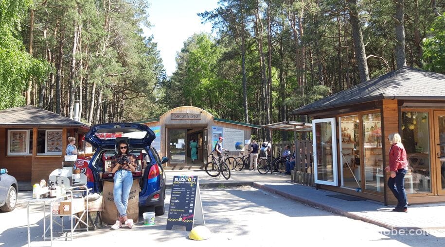
Efa height (Walnut Dune)
The height of Efa is the highest point of the Curonian Spit (Orekhovaya Dunes; German name: Petsch), where there are several observation platforms.
Orekhovaya Dune is one of the highest dunes in Europe. The highest point of the dune, located at an altitude of 62 meters, is the Efa height, named after the dune inspector Franz Efa, whose activity was devoted to the study and consolidation of the mobile sands of the Curonian Spit.
The height of the Efa is a public ecological trail (hiking route), with a length of 2.8 kilometers, which runs on 42.2 kilometers of the spit, 2 kilometers from the village of Morskoye.
Near the beginning of the route there is a Parking lot, there is a mini-market with souvenir shops, cafes and toilets.
The top of the trail, where the observation platforms are located, is located on the border of two types of dunes: Orekhovaya and Staroderevenskaya (the former German name Altdorferberg) - "green", secured by forest planting, and "white" open sand, continuing to move towards the Curonian Lagoon.
From the observation points at the end of the route, beautiful panoramic views open up, giving the opportunity to get acquainted with the variety of landscapes of the Curonian Spit. The village of Morskoye is visible, the Orekhovaya dune and the Curonian Lagoon are clearly visible.

From the beginning of the route "Efa Height" you can go to the Baltic Sea, where there are cafes, an observation deck and a descent to the sandy beach is equipped.
Visiting the route, viewing platforms and access to the sea are free (free). Learn more about the route "Efa Height" and access to the Baltic Sea…
The village of Morskoye
The village of Morskoye (until 1946 - Pillkoppen) is the last of the settlements of the Curonian Spit of Russia.
The history of the village is rooted in the deep past. According to legend, earlier in this place there was a pagan fortress of Pilkup, whose inhabitants called themselves Krivintsy. They believed that in ancient times there was a place of worship on the site of their settlement, founded by pagan priests of the highest rank and the closest assistants of the high priest of the Prussians, Kriva-Krivaito.
In 1283, on the site of the sanctuary, the Teutonic Knights created a castle called Neuhaus, near which the settlement of Neustadt later arose. Since 1663, the name of the settlement began to sound like Pillkon, and in the German version - Pillkoppen.
During the history of the village, it changed its location three times, thereby escaping from the onset of wandering dunes-so that the houses were not covered with sand, but for the first time it still "drowned" in the sand of the Altdorferberg dune (Staroderevenskaya).
Today it is a small residential village with cafes, restaurants and accommodation facilities for tourists.
The sights of the Sea are: the coastal battery "Raul" - a fortification built on the Curonian Spit on the eve of the Second World War; the cross of worship; the church of the Smolensk Icon of the Mother of God "Odigitria".
The village is separated from the Curonian Lagoon by a lagoon with a sand spit. The origin of the lagoon is associated with the conduct of modern coastal protection works carried out to prevent erosion of the bay shore and the threat of flooding of houses standing on the shore. An artificially washed sand spit with reed islands was created, and the washed soil was fixed with willow and pine plantings.
There is an exit to the Baltic Sea from the village; there are cafes nearby.
Coordinates of the village of Morskoye: 55°14 '00.0" N 20°55'00.0" E (55.233333, 20.916667).
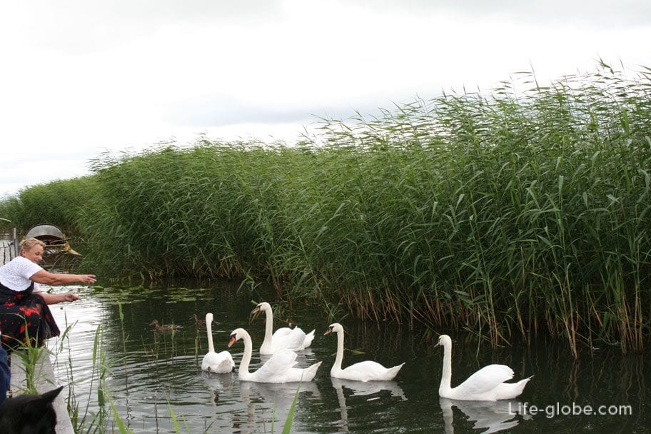
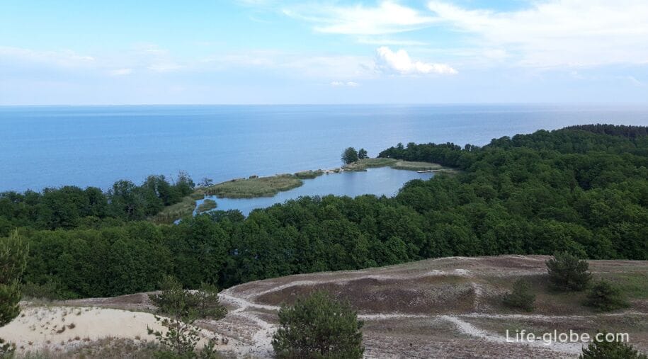
Swan Lake
Lake Lebed is not only the most picturesque lake of the Curonian Spit, but also unique, since it is the only reservoir of Aeolian origin on the spit, which appeared relatively recently in the small bay.
The lake is located on the coastal plain of the Curonian Lagoon of the Spit, at the foot of a dune ridge and is separated from the bay by a thin strip of land, and is surrounded by a moist alder forest.
The name "Swan" was given to the lake because it is home to waterfowl: sibilant swans, as well as coot ducks, chomgi, mallards and gray herons.
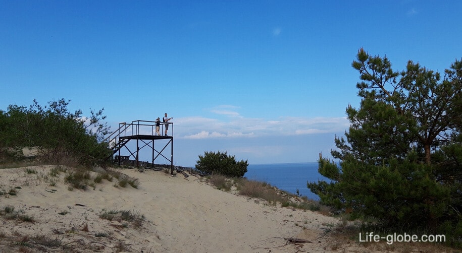
There is an observation deck on a hill, not far from Lake Swan. The descent to the lake itself along the eastern slope of the dunes is prohibited in order to avoid the destruction of the avandune.
There is a 3-kilometer public walking route to the observation deck of Lake Swan, which runs along the 46 kilometer spit, near the village of Morskoye.
In the opposite side of the spit from the lake there is an exit to the Baltic Sea coast.
Visiting the route, the observation deck and access to the sea are free (free). Learn more about Lake Swan, the route and the observation deck…

Practical information
The Curonian Spit Park is open all year round.
The best time to visit the Curonian Spit National Park is September-October. Autumn on the Curonian Spit is usually warm and mostly sunny weather until mid-October.
It is easy to navigate the spit by following the signs. Tourist trails are equipped with information boards.
For the convenience of independent travel on the spit, you can use a personal guide to the national park, which is a software (application) for iPhone/iPad, as well as Android-based devices. After installation on a personal device, the application does not require an Internet connection or cellular communication, it works completely independently. Learn more about the app: park-kosa.ru/rekomendaczii-i-sovetyi.
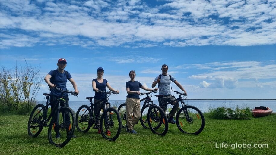
You can get to the Curonian Spit, including all routes along the spit, by taxi or car from anywhere in the Kaliningrad region, as well as by buses from the center of Kaliningrad, from Zelenogradsk and Svetlogorsk (including Otradnoye and Pionerskiy resort).
More information about all the ways to get to the Curonian Spit, about the entrance to the spit and how to move along it, can be found here →
You can also visit the Curonian Spit, including its sights, with an excursion
Excursions to the Curonian Spit from Kaliningrad
Excursions to the Curonian Spit from Svetlogorsk
Excursions to the Curonian Spit from Zelenogradsk
You can stay on the Curonian Spit in the villages of Lesnoy, Rybachy and Morskoe. There are hotels, apartments, holiday homes, camp sites.
All accommodation facilities in the village of Lesnoy can be viewed and booked here
All accommodation facilities in the village of Rybachy can be viewed and booked here
All accommodation facilities in the village of Morskoye can be viewed and booked here


