The Isar River originates in the Austrian Alps (Tyrol), flows through Bavaria and flows into the Danube near the German city of Deggendorf.
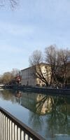
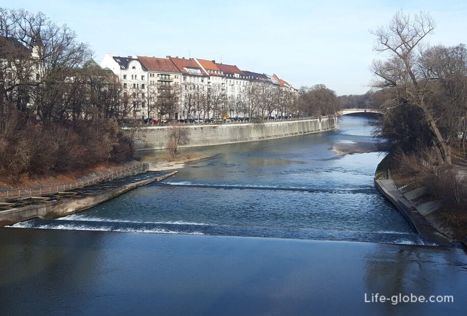
The Isar flows, among other things, through the entire city of Munich, in a direction from south to north. In Munich, the Isar has a length of 14 kilometers and passes in close proximity to the main attractions of the city, such as: the old town, the largest Protestant church in Munich - St. Luke's and the large park - English Garden.
Since the middle ages ISAR played a big role for me. The bridges over the river were trading Tupi and Islands on the river was used for storing coal and wood.
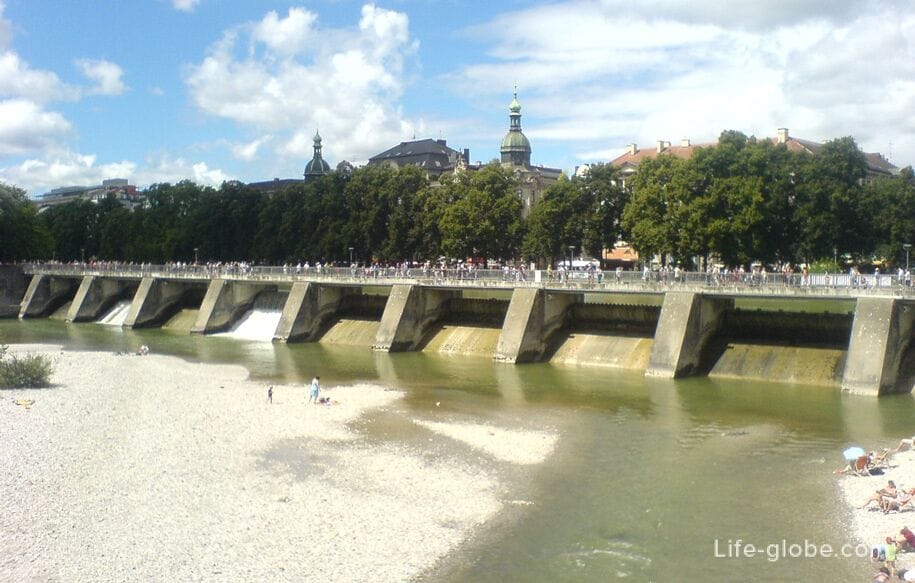
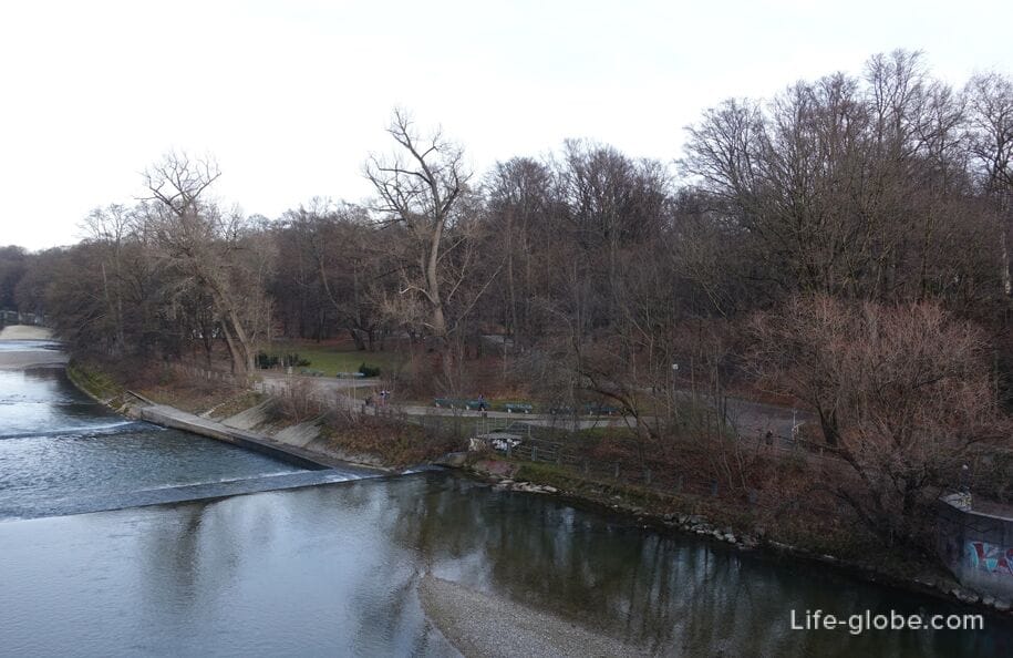
Currently, ISAR also have significant value for Munich: provides the city with water and electricity, built hydroelectric power plants, and due to the natural river landscape of the ISAR, with its gently sloping, sand and green banks, and floodplains, the river forms an important Central area in Munich.
On warm summer days, the coast of the ISAR in Munich is a popular spot for picnics and sunbathing. In fact, ISAR can swim, there is a place for surfing. On the coast of the allocated BBQ areas.
The most lively and popular place for summer recreation and swimming is the southern part of the river in the city - near the Flaucher (Flaucher) and the surrounding area. Read more about recreation on the river ISAR in Munich: swimming, barbeque, surfing, walking and...
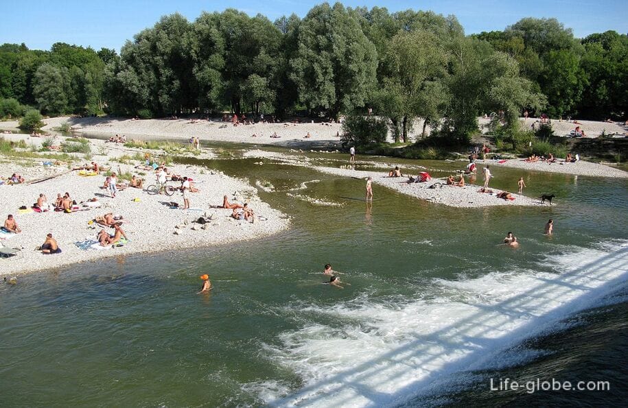
At any time of the year the banks of the ISAR offer guests and residents a place for recreation, walking and practicing certain sports (running, Biking, rollerblading, etc.).
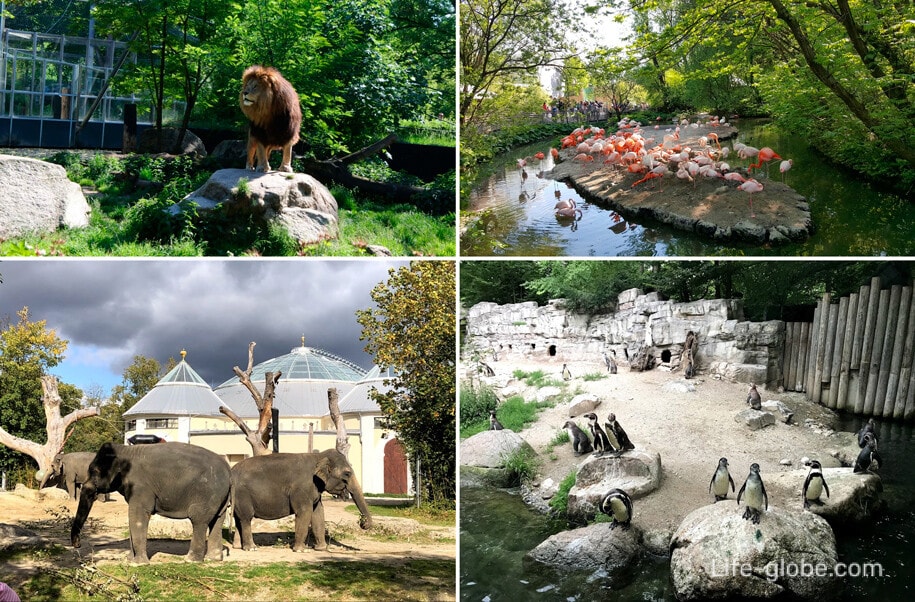
So, in the southern part of the city, on the East Bank of the ISAR is located in a quiet area of the zoo (Münchner Tierpark Hellabrunn), which is geotopia where the animals are housed in spacious enclosures in accordance with the habitats: from the Arctic circle to Africa, from Europe to Asia and from America to Australia.
Address of the zoo: Techextreme, 30 (Tierparkstraße). The website of the zoo: hellabrunn.
You can walk along the embankments and parks along the river and(or) numerous bridges over the river that connects the two banks of the river and the Islands situated on the ISAR.
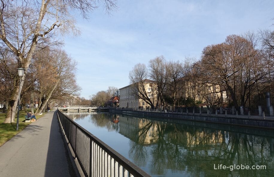
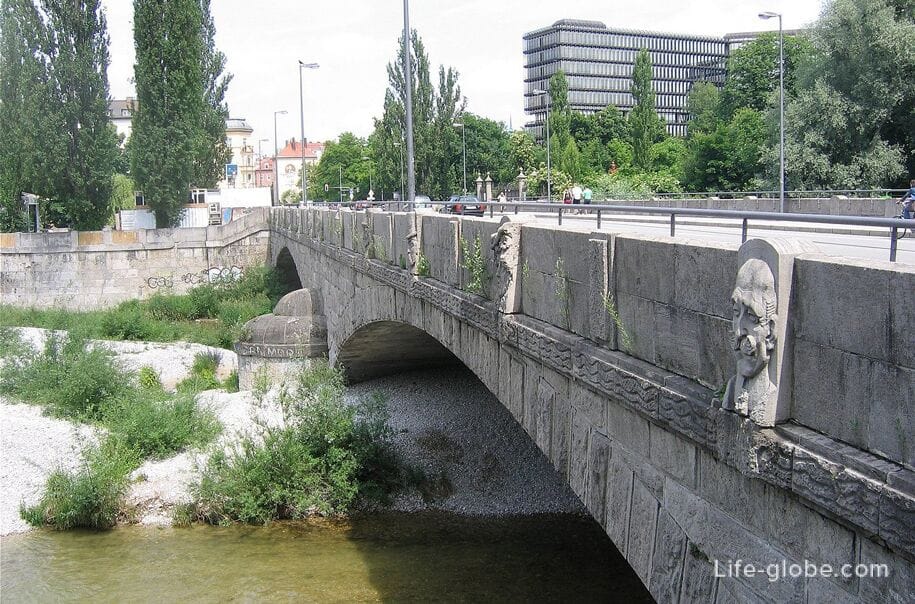
Some of the bridges represent engineering monuments, while others are completely pedestrian.
With bridges across the ISAR beautiful panoramic views of the river itself and the bridges and the surrounding area.
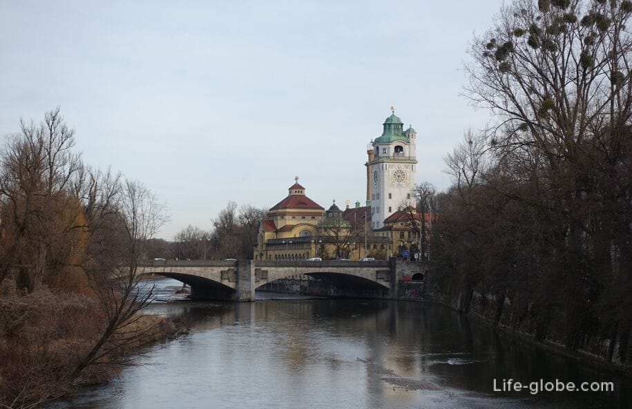
View of the ISAR in the Northern direction from the bridge to the Maximilian
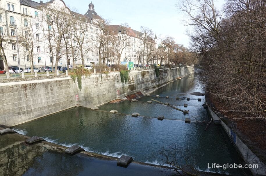
Overlooking the river ISAR and St. Maximilian Church

View of the ISAR river and East river Bank - the dome and tower of the Church of St. Luke (left)

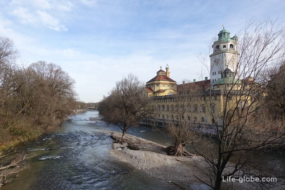
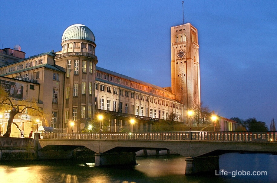
The view from the Ludwig bridge over the river ISAR and the historical building Müller's baths (right)
The bridges, the embankments and Islands of the river ISAR in Central Munich
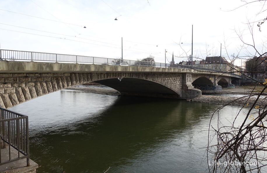
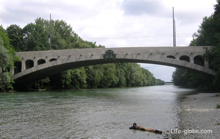
Bridge Reichenbach
Bridge Reichenbach or Reichenbachii bridge (Reichenbachbrücke / Reichenbachstrasse) is a concrete-and-stone arched bridge over the ISAR. Has a length of about 140 meters and was built in 1846, and subsequently a bit shifted and strengthened.
The bridge is named in honor of the Bavarian inventor and engineer Georg Friedrich von Reichenbach.
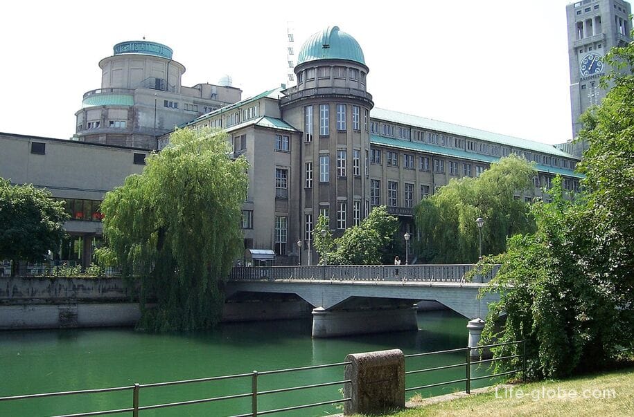
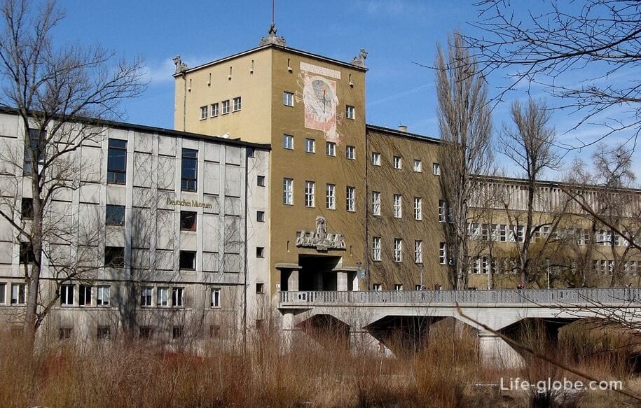
The Museum island and the bridges
Museum island (Museumsinsel / Museumsinsel) is located on the river ISAR in Central Munich.
The island consists of two parts, separated by the bridge of Ludwig:
the southern and greater part of the Museum island is one of the most popular and visited places in Munich, because there is a German Museum of masterpieces of science and technology (Deutsches Museum), which represents more than 30 thousand exhibits from 50 fields of science and engineering, from astrophysics to cell biology. Read more about German Museum.
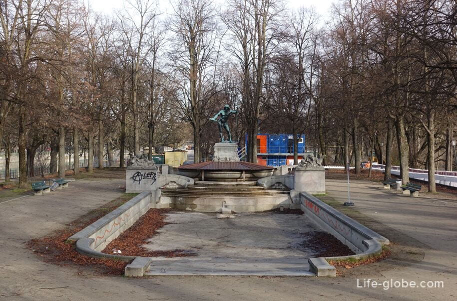
the Northern and smaller part of the island currently is a small Park with a fountain, Father Rhine (Vater-Rhein-Brunnen / Vater-Rhein-Brunnen), which is decorated with a sculpture of the God of the river Rhine.
The Museum island are five bridges, one of which is a fully pedestrian bridge-dam:
- arched bridge of Cornelius (Corneliusbrücke / Kornhausbrucke), located on the South side of the island and designed by German architect Friedrich von Tarsem. Construction began in the summer of 1902;
- axle Bosch (Boschbrücke / Bosebrucke), leading from the West Bank of the river ISAR (the heart of Munich-Isarvorstadt) on Museum island (German Museum).
Concrete beam bridge was built in 1925 for the opening of the Deutsches Museum and named in honor of Johann Baptist Bosch, the former head of the Munich office of civilian construction;
- bridge Zeneca (Zenneckbrücke / Tennenbronn), connecting the Eastern shore of the river ISAR (district of AU-Haidhausen) Museum island (German Museum).
This bridge is the sister bridge of BOSH and the other located on the East side of Museum island;
- Ludwig bridge (Ludwigsbrücke / Ludwigsbrucke), crossing the Museum island and is a dividing strip of the island into South and North parts.
The bridge we can see today dates from the 1934-1935 years of construction.
On the West side of the bridge there are three pylons with allegorical sculptures. Read more about the bridge by Ludwig...
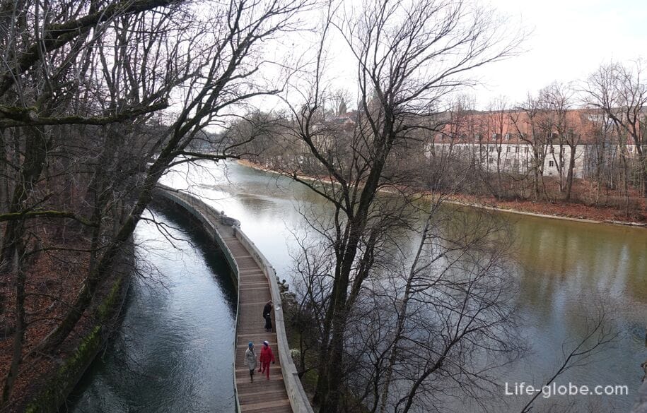
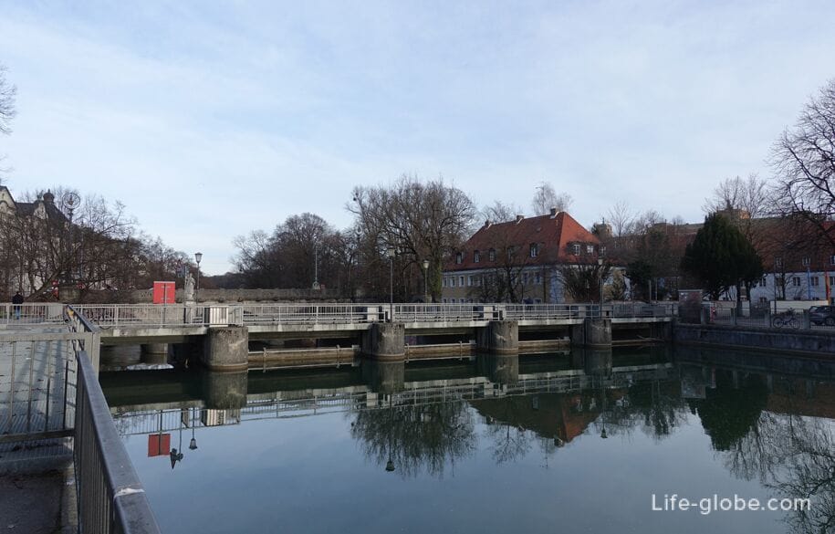
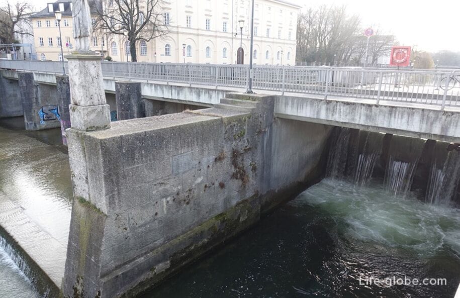
- the bridge of Versteeg / Versteeg (Wehrsteg) - a pedestrian bridge that crosses over the dam on the river ISAR, which connects two of the island: Museum island (Northern tip) and the southern tip of the island of Prater.
Water is drained from a Large ISAR (West fork) in a Small ISAR (East fork) in ten drainage holes. The existing system was built in 1966.
The length of the bridge-dam is about 170 meters. Read more about Museum island and the bridges...
The island of Prater and bridges
The Prater island (Praterinsel / Praterinsel) is a small island located on the river ISAR in Central Munich.
The island consists of two parts separated by a bridge of Maximilian.
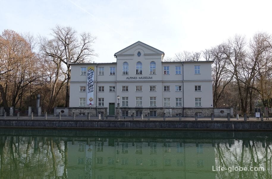
On the island of the Prater is located: buildings, a small Park, children's Playground, rental spaces and a beach club and the Alpine Museum (Alpines Museum), a permanent exhibition which, among other things, demonstrates the touristic use of the Alps.
A view of the Auer mühlbach stream, the river ISAR, and partly on the island of the Prater (right)
To the island of the Prater are five bridges, three of which are pedestrian-only - one dam bridge Versteeg, connecting the island of the Prater Museum island:
- Mariannensis bridge or bridge Marianne (Mariannenbrücke) linking the Western Bank of the river with the southern tip of the island of Prater.
Mariannenruh was built in 1888 as a wooden bridge on the occasion of the National exhibition of decorative art in Germany.
In 1928 the condition of the old wooden bridge was so bad that there was a danger of collapse. In 1929, built a new bridge in the form of a multi-span girder bridge of reinforced concrete slabs with three flat arches.
The bridge is named in honor of Maria Anna of Saxony, wife of the Bavarian elector Maximilian III Joseph. Today it is a pedestrian bridge;

- Cable-stayed bridge (Kabelsteg / Kaballah), which is a direct continuation of Mariannensis of the bridge leading from the island to the Eastern Bank of the river.
The bridge in art Nouveau style, made of reinforced concrete with two wide, flat arches and a hole between the arches, which serves to reduce the load on the bridge and the resistance zone when flooding, was built in 1898.
The total length of the bridge is 76.5 meters.
The name of the bridge comes from the earlier use, such as a transition to supply water and electricity through the ISAR. The bridge is a monument of architecture and pedestrian -;
- Preverse bridge or bridge Prever (Praterwehrbrücke / Preserverance) connecting the West Bank of the river ISAR with Prater island.
This is the only bridge which connects the island of Prater on the car. Under the bridge the dam is located, which is an important drainage system internal Isartor channel. Read more about the bridge Pretier...
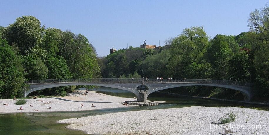
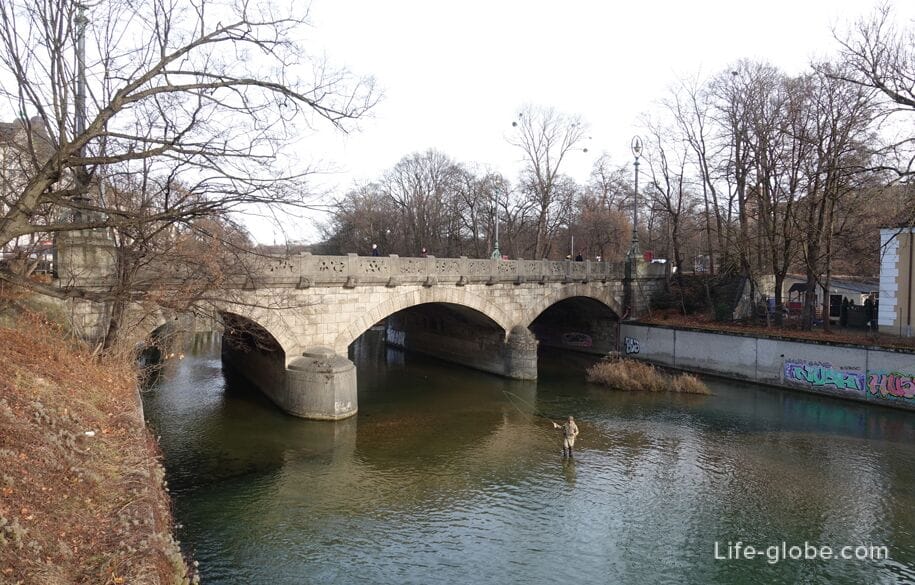
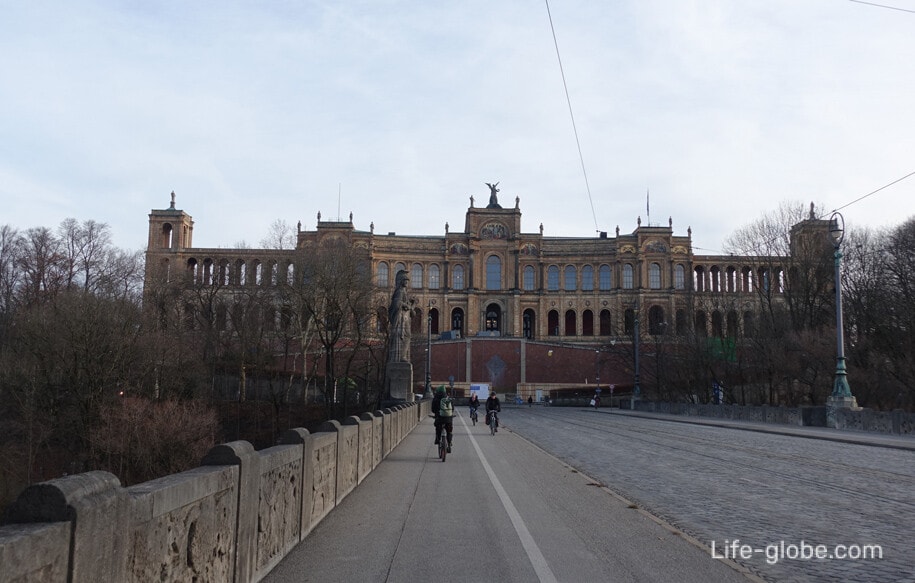
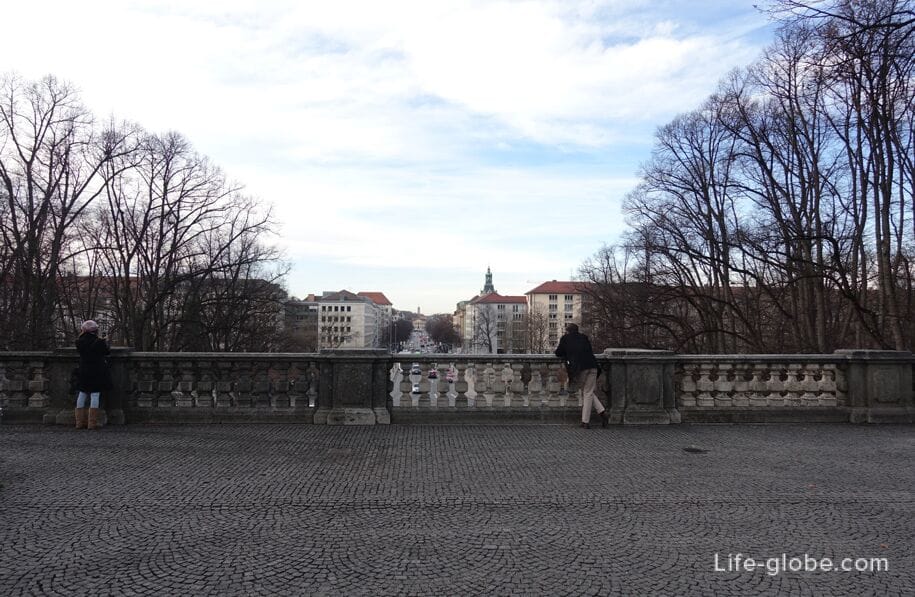
- the Maximilian bridge (Maximiliansbrücke / Maximiliansstube), which is an architectural monument and is named in honor of the Bavarian king Maximilian II.
On the bridge are two carriageways of the road and the sidewalk, one on each side of the bridge. Read more about the Maximilian bridge...

In the East, the Maximilian bridge leads to the historical building of the Maximilianeum (Maximilianeum), which is the seat of the Maximilianeum Foundation for gifted students and the seat of the Bavarian Landtag (Bavarian state Parliament). Read more about the Maximilianeum... read More about the island, the Prater and the bridges...
Park Maximiliansanlagen
Park Maximiliansanlagen (Maximiliansanlagen) is located directly at the banks of the river.
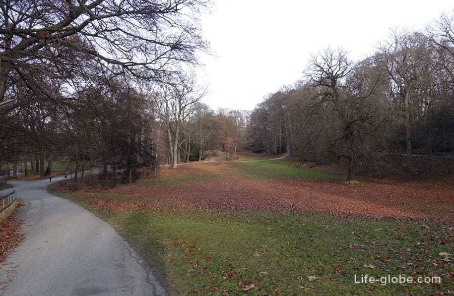
The Park covers almost 30 hectares, stretches for 2 kilometers along the East Bank of the ISAR and is one of the favorite places in the city for sports, walks and rest.
In the Park: the abundance of greenery, paths and trails for walking, places for rest and terraces.
In the summer on the banks of the river among locals and guests of the city. And in the snowy winter days a small hilly parts of the Park are used for sledding and boats. Read more about the Park Maximiliansanlagen...
View of the hand, the ISAR and the Park Maximiliansanlagen (right) from the bridge of Maximilian
Bridge Luitpold
The Luitpold bridge (Luitpoldbrücke / Luitpoldblock) was built in 1891 as part of the street Prinzregentenstrasse (Prinzregentenstraße) and paid for by the Prince-Regent Luitpold from its own funds.
Initially, the bridge was steel. After the September floods in 1899, the bridge collapsed. In 1901, when financing Luitpold was built a new stone bridge, which still exists today.
The bridge is decorated with four large stone sculptures symbolizing the four Bavarian parts: the old part of Bavaria, for Swabia, and the Palatinate Franconia . Read more about Luitpold bridge...

View of the bridge from the bridge Luitpold Maximilian
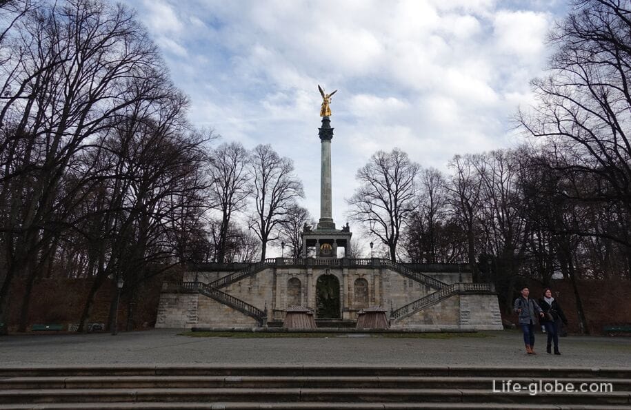
In the East, the bridge Luitpold leads to the memorial angel of peace (Friedensengel / Friedensengel), dedicated to the 25th anniversary of the peace Treaty after the Franco-Prussian war of 1870-1871 years.
Peace monument consists of an open square temple, built in Greco-Ionian pattern, and high columns in the Corinthian style, which is decorated with a bronze figure of a Golden angel.
Near the column is open area - terrace Prinzregent-Luitpold (Prinzregent-Luitpold-Terrasse), with a panoramic view of the street Prinzregentenstrasse and part of the historic center of Munich. Read more about memorial angel of peace and observation...
Bridge Max Joseph
The bridge of max Joseph (Max-Joseph-Brücke / Max-Joseph-Brücke) is an arch bridge across the ISAR and was named in honor of the Bavarian king Maximilian I Joseph.
The bridge is also known under its original name as the bridge Bogenhausen (Bogenhausener Brücke) and called the Tivoli bridge (Tivolibrücke).
The construction of the stone bridge, which exists today, began in November 1901. This bridge replaced the iron bridge, which was destroyed September 13, 1899 as a result of severe flooding.
The arched bridge is quite simple in execution, because during its construction it was situated outside of Munich and were mainly used for freight.
After the bridge had survived the second world war virtually unscathed, it was completely renovated in the 1970-ies.
Today, the max Joseph bridge connects the Munich district of Munich (Bogenhausen) - East side of the river and English garden - West side of the river.
English garden
In the North of Munich, along the West Bank of the ISAR, lies the beautiful English garden (Englischer Garten) is a large public Park, which is one of the largest urban parks in the world.
Currently, the English garden is a popular place for walks, rest and sport, both among locals and visitors alike.
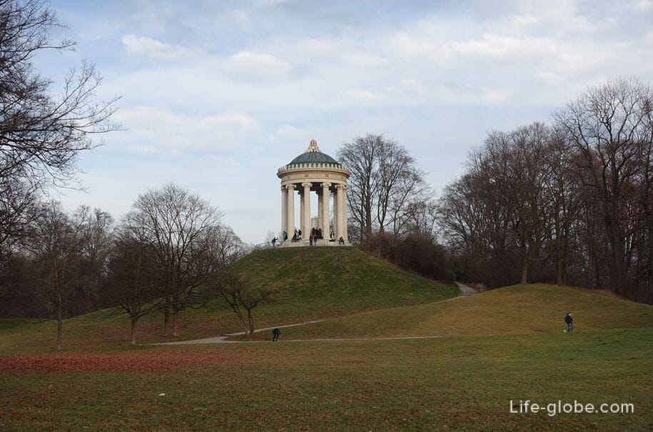
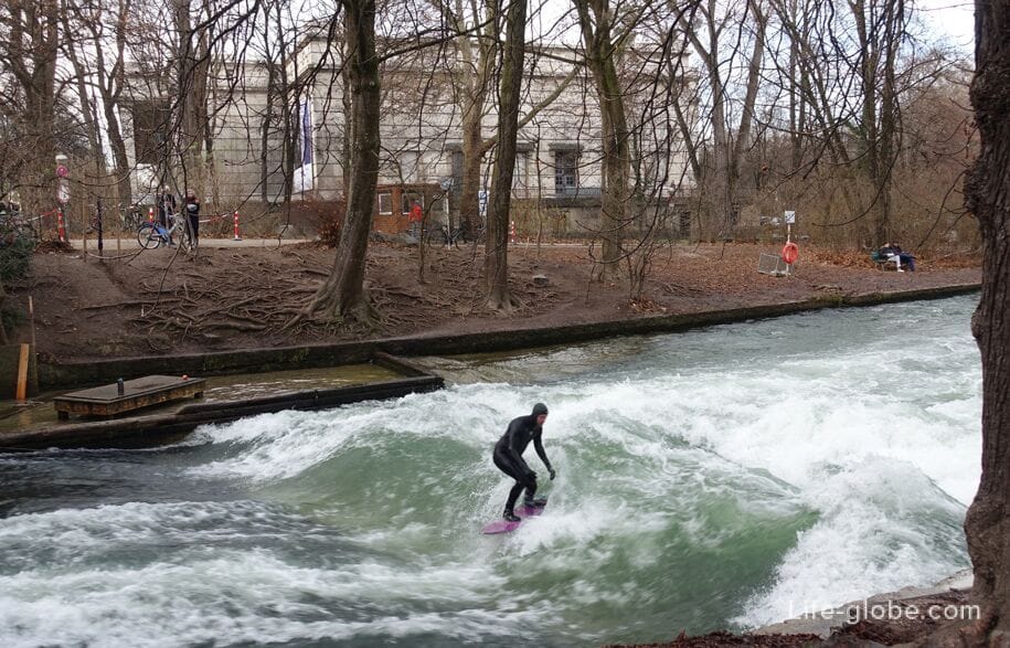
In the Park there are several significant attractions including: the observation deck with rotunda, Japanese tea house, Chinese tower, the wave of the "Eisbach", restaurants with beer gardens, etc.

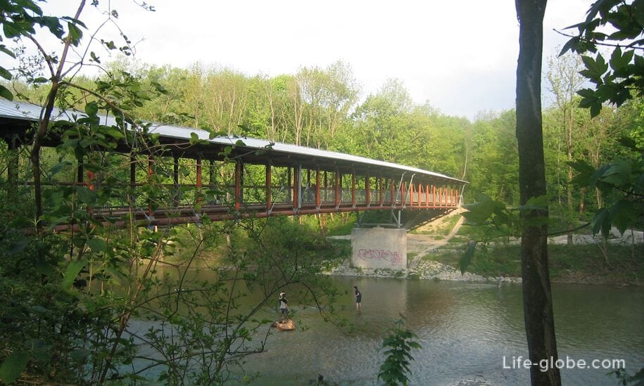
In the Northern part of the English garden is the bridge of St. Emmeram (St. Emmeram Brücke), which connects the Park with a small green area with Playground and area of Munich - St. Emmeram (St. Emmeram), located on the East Bank of the river ISAR.
Bridge with metal shed has a length of about 100 meters and is intended only for pedestrians and cyclists.
The bridge, in place of the current, existed before the Foundation of Munich, but in the Middle ages was destroyed. In 1978 was created the wooden bridge that burned down in 2002. Later the bridge was restored and reopened in December 2004. Read more about English garden with a wave of the "Eisbach"...
All accommodation in Munich, including near the river ISAR and the city centre, you can view and book here